Bushtyno geodata
Bushtyno (Transcarpathia) is a populated place; located in Ukraine in Europe/Uzhgorod (GMT+3) time zone. With population of 8,236 people, there are 429 cities with bigger population in this country. Compared to other cities in Ukraine, 55.7% of cities are located further ↑North; 95.9% of cities are located further →East and 70% of cities have lower elevation than Bushtyno. Note1


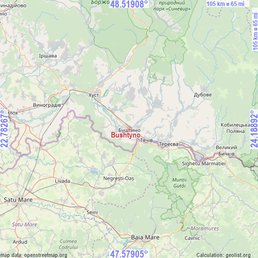
Bushtyno GPS coordinates[2]
48° 3' 4.356" North, 23° 29' 8.844" East
| Map corner | latitude | longitude |
|---|---|---|
| Upper-left | 48.51908°, | 22.78267° |
| Center: | 48.05121°, | 23.48579° |
| Lower-right: | 47.57905°, | 24.18892° |
| Map W x H: | 104.5×104.5 km | = 64.9×64.9mi |
| max Lat: | 52.18903° ⇑55.7% North |
| Bushtyno: | 48.05121° |
| min Lat: | ⇓44.3% South 44.39214° |
| min Long | Bushtyno | max Long |
| 22.20555° | 23.48579° | 40.13222° |
| W 4.1%⇐ | ⇒95.9% E |
Elevation
Elevation of Bushtyno is 206 m = 676 ft, and this is 50.2 m = 165 ft above average elevation for this country.
| Max E: |
886 m = 2907 ft | 30% |
| Bushtyno | 206 m 676 ft | |
| Avg. | 155.8 m = 511 ft | |
Min E: |
-3 m = -10 ft | 70% |
See also: Ukraine elevation on elevation.city.
Geographical zone
Bushtyno is located in North temperate zone (between Tropic of Cancer and the Arctic Circle). Distance of this North polar circle is 2058.4 km =1279 mi to North.| Distance of | km | miles | from Bushtyno |
|---|---|---|---|
| North Pole | 4664.3 | 2898.3 | to North |
| Arctic Circle | 2058.4 | 1279 | to North |
| Tropic Cancer | 2736.9 | 1700.6 | to South |
| Equator | 5342.8 | 3319.9 | to South |


Nearby cities:
15 places around Bushtyno: (largest is in red/bold)
• Berezovo
28.7 km =17.8 mi,  358°
358°
• Drahovo
21 km =13 mi,  12°
12°
• Horinchovo
24.7 km =15.3 mi,  351°
351°
• Iza
21.6 km =13.4 mi,  327°
327°
• Kalyny
30.5 km =19 mi,  70°
70°
• Khust
19.9 km =12.4 mi,  315°
315°
• Kopashnovo
18.7 km =11.6 mi, 359°
• Korolevo
28.3 km =17.6 mi,  293°
293°
• Kryva
22.9 km =14.2 mi,  306°
306°
• Lypcha
24.5 km =15.2 mi,  341°
341°
• Neresnytsya
22.1 km =13.7 mi, 70°
• Nyzhnye Selyshche
16.7 km =10.4 mi, 350°
• Rokosovo
29 km =18 mi, 307°
• Tyachiv
7.7 km =4.8 mi,  124°
124°
• Vyshkovo
4.8 km =3 mi,  267°
267°
Sources, notices
• [Note1] Compared only with cities in Ukraine existing in our database
• [Src1] Map data: © OpenStreetMap contributors (CC-BY-SA)
• [Src2] Other city data from geonames.org with taken over terms of usage.
• [Src3] Geographical zone / Annual Mean Temperature by Robert A. Rohde @ Wikipedia
