Bazaliya geodata
Bazaliya (Khmelnytskyi) is a populated place; located in Ukraine in Europe/Kiev (GMT+3) time zone. With population of 2,035 people, there are 1102 cities with bigger population in this country. Compared to other cities in Ukraine, 78.3% of cities are located further ↓South; 79.4% of cities are located further →East and 89.5% of cities have lower elevation than Bazaliya. Note1


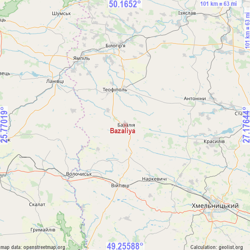
Bazaliya GPS coordinates[2]
49° 42' 45.612" North, 26° 28' 23.916" East
| Map corner | latitude | longitude |
|---|---|---|
| Upper-left | 50.1652°, | 25.77019° |
| Center: | 49.71267°, | 26.47331° |
| Lower-right: | 49.25588°, | 27.17644° |
| Map W x H: | 101.1×101.1 km | = 62.8×62.8mi |
| max Lat: | 52.18903° ⇑21.7% North |
| Bazaliya: | 49.71267° |
| min Lat: | ⇓78.3% South 44.39214° |
| min Long | Bazaliya | max Long |
| 22.20555° | 26.47331° | 40.13222° |
| W 20.6%⇐ | ⇒79.4% E |
Elevation
Elevation of Bazaliya is 303 m = 994 ft, and this is 147.2 m = 483 ft above average elevation for this country.
| Max E: |
886 m = 2907 ft | 10.5% |
| Bazaliya | 303 m 994 ft | |
| Avg. | 155.8 m = 511 ft | |
Min E: |
-3 m = -10 ft | 89.5% |
See also: Ukraine elevation on elevation.city.
Geographical zone
Bazaliya is located in North temperate zone (between Tropic of Cancer and the Arctic Circle). Distance of this North polar circle is 1873.6 km =1164.2 mi to North.| Distance of | km | miles | from Bazaliya |
|---|---|---|---|
| North Pole | 4479.5 | 2783.4 | to North |
| Arctic Circle | 1873.6 | 1164.2 | to North |
| Tropic Cancer | 2921.6 | 1815.4 | to South |
| Equator | 5527.5 | 3434.6 | to South |


Nearby cities:
15 places around Bazaliya: (largest is in red/bold)
• Antoniny
30.9 km =19.2 mi,  69°
69°
• Hrymayliv
53.9 km =33.5 mi,  218°
218°
• Izyaslav
51.6 km =32.1 mi,  28°
28°
• Khmelnytskyi
49.7 km =30.9 mi,  130°
130°
• Krasyliv
36.5 km =22.7 mi,  100°
100°
• Lanivtsi
32.2 km =20 mi,  301°
301°
• Lyakhovtsy
32.4 km =20.1 mi,  354°
354°
• Narkevychi
24.9 km =15.5 mi,  150°
150°
• Pidvolochysk
30.8 km =19.1 mi,  230°
230°
• Shumsk
52.2 km =32.4 mi,  330°
330°
• Skalat
47.7 km =29.6 mi, 228°
• Starokostiantyniv
52.7 km =32.7 mi,  84°
84°
• Teofipol
14.6 km =9.1 mi,  343°
343°
• Volochysk
26.9 km =16.7 mi, 223°
• Zbarazh
50.4 km =31.3 mi,  263°
263°
Sources, notices
• [Note1] Compared only with cities in Ukraine existing in our database
• [Src1] Map data: © OpenStreetMap contributors (CC-BY-SA)
• [Src2] Other city data from geonames.org with taken over terms of usage.
• [Src3] Geographical zone / Annual Mean Temperature by Robert A. Rohde @ Wikipedia
