Lyakhovtsy geodata
Lyakhovtsy (Khmelnytskyi) is a seat of a second-order administrative division; located in Ukraine in Europe/Kiev (GMT+3) time zone. In our database, there are 1661 cities with bigger population. Compared to other cities in Ukraine, 83.9% of cities are located further ↓South; 79.5% of cities are located further →East and 79.2% of cities have lower elevation than Lyakhovtsy. Note1


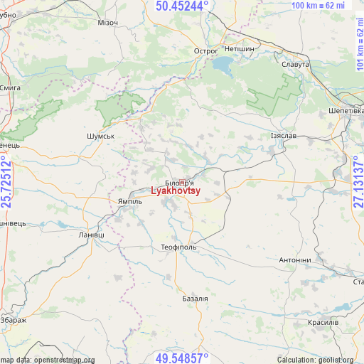
Lyakhovtsy GPS coordinates[2]
50° 0' 9.468" North, 26° 25' 41.664" East
| Map corner | latitude | longitude |
|---|---|---|
| Upper-left | 50.45244°, | 25.72512° |
| Center: | 50.00263°, | 26.42824° |
| Lower-right: | 49.54857°, | 27.13137° |
| Map W x H: | 100.5×100.5 km | = 62.4×62.4mi |
| max Lat: | 52.18903° ⇑16.1% North |
| Lyakhovtsy: | 50.00263° |
| min Lat: | ⇓83.9% South 44.39214° |
| min Long | Lyakhovtsy | max Long |
| 22.20555° | 26.42824° | 40.13222° |
| W 20.5%⇐ | ⇒79.5% E |
Elevation
Elevation of Lyakhovtsy is 243 m = 797 ft, and this is 87.2 m = 286 ft above average elevation for this country.
| Max E: |
886 m = 2907 ft | 20.8% |
| Lyakhovtsy | 243 m 797 ft | |
| Avg. | 155.8 m = 511 ft | |
Min E: |
-3 m = -10 ft | 79.2% |
See also: Ukraine elevation on elevation.city.
Geographical zone
Lyakhovtsy is located in North temperate zone (between Tropic of Cancer and the Arctic Circle). Distance of this North polar circle is 1841.4 km =1144.2 mi to North.| Distance of | km | miles | from Lyakhovtsy |
|---|---|---|---|
| North Pole | 4447.3 | 2763.4 | to North |
| Arctic Circle | 1841.4 | 1144.2 | to North |
| Tropic Cancer | 2953.9 | 1835.5 | to South |
| Equator | 5559.8 | 3454.7 | to South |


Nearby cities:
15 places around Lyakhovtsy: (largest is in red/bold)
• Antoniny
38.6 km =24 mi,  123°
123°
• Bazaliya
32.4 km =20.1 mi,  174°
174°
• Izyaslav
30.9 km =19.2 mi,  65°
65°
• Krasyliv
55.2 km =34.3 mi,  134°
134°
• Kremenets
51.3 km =31.9 mi,  281°
281°
• Lanivtsi
28.7 km =17.8 mi,  237°
237°
• Mizoch
48.4 km =30.1 mi,  335°
335°
• Netishyn
40.5 km =25.2 mi,  22°
22°
• Ostroh
36.8 km =22.9 mi,  9°
9°
• Shepetivka
49.7 km =30.9 mi, 65°
• Shumsk
26 km =16.2 mi,  300°
300°
• Slavuta
45.5 km =28.3 mi,  43°
43°
• Smyga
54.1 km =33.6 mi, 299°
• Teofipol
18.3 km =11.4 mi,  183°
183°
• Volochysk
53.9 km =33.5 mi,  196°
196°
Sources, notices
• [Note1] Compared only with cities in Ukraine existing in our database
• [Src1] Map data: © OpenStreetMap contributors (CC-BY-SA)
• [Src2] Other city data from geonames.org with taken over terms of usage.
• [Src3] Geographical zone / Annual Mean Temperature by Robert A. Rohde @ Wikipedia
