Hrymayliv geodata
Hrymayliv (Ternopil) is a populated place; located in Ukraine in Europe/Kiev (GMT+3) time zone. With population of 2,051 people, there are 1101 cities with bigger population in this country. Compared to other cities in Ukraine, 71.4% of cities are located further ↓South; 81% of cities are located further →East and 90.2% of cities have lower elevation than Hrymayliv. Note1


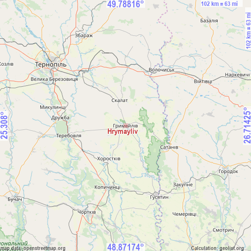
Hrymayliv GPS coordinates[2]
49° 19' 55.488" North, 26° 0' 40.032" East
| Map corner | latitude | longitude |
|---|---|---|
| Upper-left | 49.78816°, | 25.308° |
| Center: | 49.33208°, | 26.01112° |
| Lower-right: | 48.87174°, | 26.71425° |
| Map W x H: | 101.9×101.9 km | = 63.3×63.3mi |
| max Lat: | 52.18903° ⇑28.6% North |
| Hrymayliv: | 49.33208° |
| min Lat: | ⇓71.4% South 44.39214° |
| min Long | Hrymayliv | max Long |
| 22.20555° | 26.01112° | 40.13222° |
| W 19%⇐ | ⇒81% E |
Elevation
Elevation of Hrymayliv is 308 m = 1010 ft, and this is 152.2 m = 499 ft above average elevation for this country.
| Max E: |
886 m = 2907 ft | 9.8% |
| Hrymayliv | 308 m 1010 ft | |
| Avg. | 155.8 m = 511 ft | |
Min E: |
-3 m = -10 ft | 90.2% |
See also: Ukraine elevation on elevation.city.
Geographical zone
Hrymayliv is located in North temperate zone (between Tropic of Cancer and the Arctic Circle). Distance of this North polar circle is 1916 km =1190.5 mi to North.| Distance of | km | miles | from Hrymayliv |
|---|---|---|---|
| North Pole | 4521.8 | 2809.7 | to North |
| Arctic Circle | 1916 | 1190.5 | to North |
| Tropic Cancer | 2879.3 | 1789.1 | to South |
| Equator | 5485.2 | 3408.3 | to South |


Nearby cities:
15 places around Hrymayliv: (largest is in red/bold)
• Belaya
38 km =23.6 mi,  207°
207°
• Chortkiv
38.3 km =23.8 mi,  203°
203°
• Husiatyn
31.5 km =19.6 mi,  156°
156°
• Husiatyn
32.9 km =20.4 mi,  152°
152°
• Khorostkiv
14.9 km =9.3 mi, 205°
• Kopychyntsi
26.4 km =16.4 mi, 196°
• Mikulintsy
30.2 km =18.8 mi,  283°
283°
• Petrikov
38.3 km =23.8 mi,  305°
305°
• Pidvolochysk
24.5 km =15.2 mi,  23°
23°
• Skalat
10.8 km =6.7 mi,  347°
347°
• Terebovlya
22.1 km =13.7 mi,  261°
261°
• Ternopil
39.2 km =24.4 mi, 308°
• Velikiye Borki
28.1 km =17.5 mi,  319°
319°
• Volochysk
27.2 km =16.9 mi,  32°
32°
• Zakupne
33.5 km =20.8 mi,  134°
134°
Sources, notices
• [Note1] Compared only with cities in Ukraine existing in our database
• [Src1] Map data: © OpenStreetMap contributors (CC-BY-SA)
• [Src2] Other city data from geonames.org with taken over terms of usage.
• [Src3] Geographical zone / Annual Mean Temperature by Robert A. Rohde @ Wikipedia
