Izyaslav geodata
Izyaslav (Khmelnytskyi) is a seat of a second-order administrative division; located in Ukraine in Europe/Kiev (GMT+3) time zone. With population of 17,758 people, there are 220 cities with bigger population in this country. Compared to other cities in Ukraine, 85.6% of cities are located further ↓South; 78.5% of cities are located further →East and 76.3% of cities have lower elevation than Izyaslav. Note1


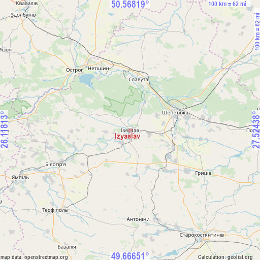
Izyaslav GPS coordinates[2]
50° 7' 10.092" North, 26° 49' 16.5" East
| Map corner | latitude | longitude |
|---|---|---|
| Upper-left | 50.56819°, | 26.11813° |
| Center: | 50.11947°, | 26.82125° |
| Lower-right: | 49.66651°, | 27.52438° |
| Map W x H: | 100.3×100.3 km | = 62.3×62.3mi |
| max Lat: | 52.18903° ⇑14.4% North |
| Izyaslav: | 50.11947° |
| min Lat: | ⇓85.6% South 44.39214° |
| min Long | Izyaslav | max Long |
| 22.20555° | 26.82125° | 40.13222° |
| W 21.5%⇐ | ⇒78.5% E |
Elevation
Elevation of Izyaslav is 231 m = 758 ft, and this is 75.2 m = 247 ft above average elevation for this country.
| Max E: |
886 m = 2907 ft | 23.7% |
| Izyaslav | 231 m 758 ft | |
| Avg. | 155.8 m = 511 ft | |
Min E: |
-3 m = -10 ft | 76.3% |
See also: Ukraine elevation on elevation.city.
Geographical zone
Izyaslav is located in North temperate zone (between Tropic of Cancer and the Arctic Circle). Distance of this North polar circle is 1828.4 km =1136.1 mi to North.| Distance of | km | miles | from Izyaslav |
|---|---|---|---|
| North Pole | 4434.3 | 2755.3 | to North |
| Arctic Circle | 1828.4 | 1136.1 | to North |
| Tropic Cancer | 2966.8 | 1843.5 | to South |
| Equator | 5572.8 | 3462.8 | to South |


Nearby cities:
15 places around Izyaslav: (largest is in red/bold)
• Antoniny
34.7 km =21.6 mi,  173°
173°
• Bazaliya
51.6 km =32.1 mi,  208°
208°
• Hoshcha
54.5 km =33.9 mi,  348°
348°
• Krasyliv
53.1 km =33 mi, 168°
• Lyakhovtsy
30.9 km =19.2 mi,  245°
245°
• Netishyn
27.7 km =17.2 mi,  332°
332°
• Novoselytsya
50.1 km =31.1 mi,  96°
96°
• Ostroh
32 km =19.9 mi,  316°
316°
• Polonne
49.2 km =30.6 mi,  89°
89°
• Poninka
51.5 km =32 mi,  81°
81°
• Shepetivka
18.8 km =11.7 mi,  66°
66°
• Shumsk
50.4 km =31.3 mi,  270°
270°
• Slavuta
20.5 km =12.7 mi,  8°
8°
• Starokostiantyniv
48.6 km =30.2 mi,  145°
145°
• Teofipol
42.7 km =26.5 mi,  222°
222°
Sources, notices
• [Note1] Compared only with cities in Ukraine existing in our database
• [Src1] Map data: © OpenStreetMap contributors (CC-BY-SA)
• [Src2] Other city data from geonames.org with taken over terms of usage.
• [Src3] Geographical zone / Annual Mean Temperature by Robert A. Rohde @ Wikipedia
