Barvinkove geodata
Barvinkove (Kharkiv) is a seat of a second-order administrative division; located in Ukraine in Europe/Kiev (GMT+3) time zone. With population of 12,344 people, there are 304 cities with bigger population in this country. Compared to other cities in Ukraine, 64.2% of cities are located further ↓South; 91% of cities are located further ←West and 64.7% of cities have higher elevation than Barvinkove. Note1


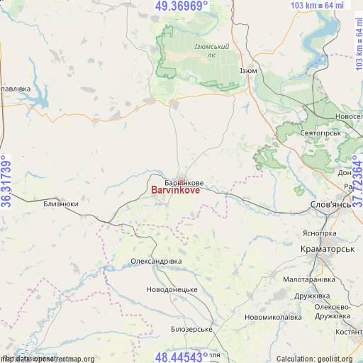
Barvinkove GPS coordinates[2]
48° 54' 34.92" North, 37° 1' 13.836" East
| Map corner | latitude | longitude |
|---|---|---|
| Upper-left | 49.36969°, | 36.31739° |
| Center: | 48.9097°, | 37.02051° |
| Lower-right: | 48.44543°, | 37.72364° |
| Map W x H: | 102.8×102.8 km | = 63.9×63.9mi |
| max Lat: | 52.18903° ⇑35.8% North |
| Barvinkove: | 48.9097° |
| min Lat: | ⇓64.2% South 44.39214° |
| min Long | Barvinkove | max Long |
| 22.20555° | 37.02051° | 40.13222° |
| W 91%⇐ | ⇒9% E |
Elevation
Elevation of Barvinkove is 92 m = 302 ft, and this is 63.8 m = 209 ft below average elevation for this country.
| Max E: |
886 m = 2907 ft | 64.7% |
| Avg. | 155.8 m = 511 ft | |
| Barvinkove | 92 m = 302 ft | |
Min E: |
-3 m = -10 ft | 35.3% |
See also: Ukraine elevation on elevation.city.
Geographical zone
Barvinkove is located in North temperate zone (between Tropic of Cancer and the Arctic Circle). Distance of this North polar circle is 1962.9 km =1219.7 mi to North.| Distance of | km | miles | from Barvinkove |
|---|---|---|---|
| North Pole | 4568.8 | 2838.9 | to North |
| Arctic Circle | 1962.9 | 1219.7 | to North |
| Tropic Cancer | 2832.3 | 1759.9 | to South |
| Equator | 5438.2 | 3379.1 | to South |


Nearby cities:
15 places around Barvinkove: (largest is in red/bold)
• Blyznyuky
34.5 km =21.4 mi,  260°
260°
• Chervonyy Oskil
42.1 km =26.2 mi,  44°
44°
• Dobropillya
50.1 km =31.1 mi,  174°
174°
• Druzhkivka
49.9 km =31 mi,  128°
128°
• Izyum
37.2 km =23.1 mi,  26°
26°
• Kramators’k
44.4 km =27.6 mi,  117°
117°
• Krasnotorka
45.3 km =28.1 mi, 124°
• Lozova
51.4 km =31.9 mi,  267°
267°
• Novodonets’ke
30.6 km =19 mi,  184°
184°
• Oleksandrivka
23.7 km =14.7 mi,  198°
198°
• Petrivs’ke
31 km =19.3 mi,  343°
343°
• Sloviansk
43.8 km =27.2 mi,  96°
96°
• Studenok
39.6 km =24.6 mi,  59°
59°
• Svyatogorsk
42.2 km =26.2 mi,  70°
70°
• Yats’kivka
47.4 km =29.5 mi,  50°
50°
Sources, notices
• [Note1] Compared only with cities in Ukraine existing in our database
• [Src1] Map data: © OpenStreetMap contributors (CC-BY-SA)
• [Src2] Other city data from geonames.org with taken over terms of usage.
• [Src3] Geographical zone / Annual Mean Temperature by Robert A. Rohde @ Wikipedia
