Avdiyivka geodata
Avdiyivka (Donetsk) is a seat of a second-order administrative division; located in Ukraine in Europe/Kiev (GMT+3) time zone. With population of 35,826 people, there are 124 cities with bigger population in this country. Compared to other cities in Ukraine, 53.7% of cities are located further ↑North; 93.5% of cities are located further ←West and 71.5% of cities have lower elevation than Avdiyivka. Note1


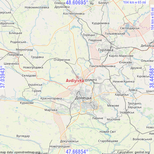
Avdiyivka GPS coordinates[2]
48° 8' 23.604" North, 37° 44' 33.18" East
| Map corner | latitude | longitude |
|---|---|---|
| Upper-left | 48.60695°, | 37.03943° |
| Center: | 48.13989°, | 37.74255° |
| Lower-right: | 47.66854°, | 38.44568° |
| Map W x H: | 104.3×104.3 km | = 64.8×64.8mi |
| max Lat: | 52.18903° ⇑53.7% North |
| Avdiyivka: | 48.13989° |
| min Lat: | ⇓46.3% South 44.39214° |
| min Long | Avdiyivka | max Long |
| 22.20555° | 37.74255° | 40.13222° |
| W 93.5%⇐ | ⇒6.5% E |
Elevation
Elevation of Avdiyivka is 212 m = 696 ft, and this is 56.2 m = 184 ft above average elevation for this country.
| Max E: |
886 m = 2907 ft | 28.5% |
| Avdiyivka | 212 m 696 ft | |
| Avg. | 155.8 m = 511 ft | |
Min E: |
-3 m = -10 ft | 71.5% |
See also: Ukraine elevation on elevation.city.
Geographical zone
Avdiyivka is located in North temperate zone (between Tropic of Cancer and the Arctic Circle). Distance of this North polar circle is 2048.5 km =1272.9 mi to North.| Distance of | km | miles | from Avdiyivka |
|---|---|---|---|
| North Pole | 4654.4 | 2892.1 | to North |
| Arctic Circle | 2048.5 | 1272.9 | to North |
| Tropic Cancer | 2746.7 | 1706.7 | to South |
| Equator | 5352.7 | 3326 | to South |


Nearby cities:
15 places around Avdiyivka: (largest is in red/bold)
• Donetsk
13.7 km =8.5 mi,  161°
161°
• Horlivka
31.7 km =19.7 mi,  46°
46°
• Khartsyz’k
32 km =19.9 mi,  109°
109°
• Krasnyy Oktyabr’
36 km =22.4 mi,  70°
70°
• Krinichnaya
21.1 km =13.1 mi,  93°
93°
• Makiyivka
17 km =10.6 mi,  126°
126°
• Mar'yinka
27.9 km =17.3 mi,  219°
219°
• Nyzhnya Krynka
31.2 km =19.4 mi,  95°
95°
• P'yatypill'ya
29.9 km =18.6 mi,  117°
117°
• Selydove
32.8 km =20.4 mi,  271°
271°
• Shcherbynivka
28.6 km =17.8 mi,  7°
7°
• Toretsk
29.8 km =18.5 mi,  15°
15°
• Vysoke
32 km =19.9 mi, 132°
• Yasynuvata
8.7 km =5.4 mi, 97°
• Yenakiyeve
36.3 km =22.6 mi, 73°
Sources, notices
• [Note1] Compared only with cities in Ukraine existing in our database
• [Src1] Map data: © OpenStreetMap contributors (CC-BY-SA)
• [Src2] Other city data from geonames.org with taken over terms of usage.
• [Src3] Geographical zone / Annual Mean Temperature by Robert A. Rohde @ Wikipedia
