Toretsk geodata
Toretsk (Donetsk) is a seat of a second-order administrative division; located in Ukraine in Europe/Kiev (GMT+3) time zone. With population of 41,758 people, there are 106 cities with bigger population in this country. Compared to other cities in Ukraine, 52.8% of cities are located further ↓South; 93.8% of cities are located further ←West and 68.8% of cities have lower elevation than Toretsk. Note1


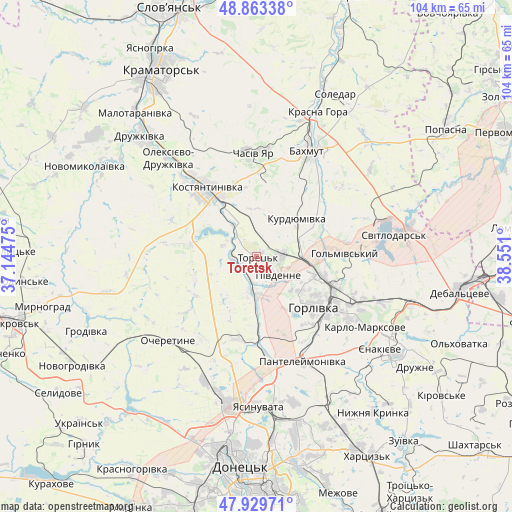
Toretsk GPS coordinates[2]
48° 23' 55.284" North, 37° 50' 52.332" East
| Map corner | latitude | longitude |
|---|---|---|
| Upper-left | 48.86338°, | 37.14475° |
| Center: | 48.39869°, | 37.84787° |
| Lower-right: | 47.92971°, | 38.551° |
| Map W x H: | 103.8×103.8 km | = 64.5×64.5mi |
| max Lat: | 52.18903° ⇑47.2% North |
| Toretsk: | 48.39869° |
| min Lat: | ⇓52.8% South 44.39214° |
| min Long | Toretsk | max Long |
| 22.20555° | 37.84787° | 40.13222° |
| W 93.8%⇐ | ⇒6.2% E |
Elevation
Elevation of Toretsk is 200 m = 656 ft, and this is 44.2 m = 145 ft above average elevation for this country.
| Max E: |
886 m = 2907 ft | 31.2% |
| Toretsk | 200 m 656 ft | |
| Avg. | 155.8 m = 511 ft | |
Min E: |
-3 m = -10 ft | 68.8% |
See also: Toretsk elevation on elevation.city.
Geographical zone
Toretsk is located in North temperate zone (between Tropic of Cancer and the Arctic Circle). Distance of this North polar circle is 2019.7 km =1255 mi to North.| Distance of | km | miles | from Toretsk |
|---|---|---|---|
| North Pole | 4625.6 | 2874.2 | to North |
| Arctic Circle | 2019.7 | 1255 | to North |
| Tropic Cancer | 2775.5 | 1724.6 | to South |
| Equator | 5381.4 | 3343.8 | to South |


Nearby cities:
15 places around Toretsk: (largest is in red/bold)
• Avdiyivka
29.8 km =18.5 mi,  195°
195°
• Bakhmut
24.6 km =15.3 mi,  27°
27°
• Chasiv Yar
21.7 km =13.5 mi,  1°
1°
• Druzhkivka
33.7 km =20.9 mi,  319°
319°
• Horlivka
16.7 km =10.4 mi,  114°
114°
• Kostyantynivka
17.7 km =11 mi, 324°
• Krasnyy Oktyabr’
30.8 km =19.1 mi,  122°
122°
• Krinichnaya
32.8 km =20.4 mi,  156°
156°
• Luhans’ke
31 km =19.3 mi,  80°
80°
• Shcherbynivka
4.2 km =2.6 mi,  264°
264°
• Soledar
35.9 km =22.3 mi, 29°
• Svetlodarsk
28 km =17.4 mi, 81°
• Vuhlehirs’k
32.9 km =20.4 mi, 106°
• Yasynuvata
29.9 km =18.6 mi,  178°
178°
• Yenakiyeve
32.6 km =20.3 mi, 124°
Sources, notices
• [Note1] Compared only with cities in Ukraine existing in our database
• [Src1] Map data: © OpenStreetMap contributors (CC-BY-SA)
• [Src2] Other city data from geonames.org with taken over terms of usage.
• [Src3] Geographical zone / Annual Mean Temperature by Robert A. Rohde @ Wikipedia
