Alushta geodata
Alushta (Republic of Crimea) is a seat of a second-order administrative division; located in Ukraine in Europe/Simferopol (GMT+3) time zone. With population of 29,586 people, there are 143 cities with bigger population in this country. Compared to other cities in Ukraine, 97.4% of cities are located further ↑North; 72.2% of cities are located further ←West and 81% of cities have higher elevation than Alushta. Note1


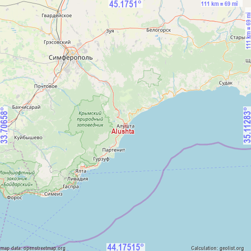
Alushta GPS coordinates[2]
44° 40' 38.208" North, 34° 24' 34.92" East
| Map corner | latitude | longitude |
|---|---|---|
| Upper-left | 45.1751°, | 33.70658° |
| Center: | 44.67728°, | 34.4097° |
| Lower-right: | 44.17515°, | 35.11283° |
| Map W x H: | 111.2×111.2 km | = 69.1×69.1mi |
| max Lat: | 52.18903° ⇑97.4% North |
| Alushta: | 44.67728° |
| min Lat: | ⇓2.6% South 44.39214° |
| min Long | Alushta | max Long |
| 22.20555° | 34.4097° | 40.13222° |
| W 72.2%⇐ | ⇒27.8% E |
Elevation
Elevation of Alushta is 40 m = 131 ft, and this is 115.8 m = 380 ft below average elevation for this country.
| Max E: |
886 m = 2907 ft | 81% |
| Avg. | 155.8 m = 511 ft | |
| Alushta | 40 m = 131 ft | |
Min E: |
-3 m = -10 ft | 19% |
See also: Ukraine elevation on elevation.city.
Geographical zone
Alushta is located in North temperate zone (between Tropic of Cancer and the Arctic Circle). Distance of this Northern Tropic circle is 2361.7 km =1467.5 mi to South.| Distance of | km | miles | from Alushta |
|---|---|---|---|
| North Pole | 5039.4 | 3131.3 | to North |
| Arctic Circle | 2433.5 | 1512.1 | to North |
| Tropic Cancer | 2361.7 | 1467.5 | to South |
| Equator | 4967.6 | 3086.7 | to South |


Nearby cities:
15 places around Alushta: (largest is in red/bold)
• Gurzuf
17.9 km =11.1 mi,  215°
215°
• Izobil’noye
5.3 km =3.3 mi,  302°
302°
• Krasnokamenka
15.8 km =9.8 mi, 217°
• Krasnolesye
22.3 km =13.9 mi,  320°
320°
• Luchistoye
6.6 km =4.1 mi,  353°
353°
• Malorechenskoye
14.8 km =9.2 mi,  52°
52°
• Maly Mayak
7.9 km =4.9 mi,  206°
206°
• Nizhnyaya Kutuzovka
4.2 km =2.6 mi,  326°
326°
• Partenit
12.2 km =7.6 mi, 205°
• Pereval'noye
20.5 km =12.7 mi,  338°
338°
• Rybach'e
18.2 km =11.3 mi, 54°
• Solnechnogorskoye
12.9 km =8 mi, 52°
• Verkhnyaya Kutuzovka
5.8 km =3.6 mi, 327°
• Zaprudnoye
11.9 km =7.4 mi, 217°
• Zarechnoye
22.4 km =13.9 mi, 329°
Sources, notices
• [Note1] Compared only with cities in Ukraine existing in our database
• [Src1] Map data: © OpenStreetMap contributors (CC-BY-SA)
• [Src2] Other city data from geonames.org with taken over terms of usage.
• [Src3] Geographical zone / Annual Mean Temperature by Robert A. Rohde @ Wikipedia
