Leola geodata
Leola (Arkansas) is a populated place; located in United States in America/Chicago (GMT-5) time zone. With population of 503 people, there are 20865 cities with bigger population in this country. Compared to other cities in United States, 79.1% of cities are located further ↑North; 65.4% of cities are located further →East and 72.5% of cities have higher elevation than Leola. Note1


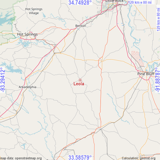
Leola GPS coordinates[2]
34° 10' 10.344" North, 92° 35' 27.564" West
| Map corner | latitude | longitude |
|---|---|---|
| Upper-left | 34.74928°, | -93.29412° |
| Center: | 34.16954°, | -92.59099° |
| Lower-right: | 33.58579°, | -91.88787° |
| Map W x H: | 129.4×129.4 km | = 80.4×80.4mi |
| max Lat: | 71.29058° ⇑79.1% North |
| Leola: | 34.16954° |
| min Lat: | ⇓20.9% South 19.06759° |
| min Long | Leola | max Long |
| -171.73463° | -92.59099° | -66.98998° |
| W 34.6%⇐ | ⇒65.4% E |
Elevation
Elevation of Leola is 86 m = 282 ft, and this is 208.8 m = 685 ft below average elevation for this country.
| Max E: |
3189 m = 10463 ft | 72.5% |
| Avg. | 294.8 m = 967 ft | |
| Leola | 86 m = 282 ft | |
Min E: |
-60 m = -197 ft | 27.5% |
See also: United States elevation on elevation.city.
Geographical zone
Leola is located in North temperate zone (between Tropic of Cancer and the Arctic Circle). Distance of this Northern Tropic circle is 1193.4 km =741.5 mi to South.| Distance of | km | miles | from Leola |
|---|---|---|---|
| North Pole | 6207.8 | 3857.3 | to North |
| Arctic Circle | 3601.9 | 2238.1 | to North |
| Tropic Cancer | 1193.4 | 741.5 | to South |
| Equator | 3799.3 | 2360.8 | to South |


Nearby cities:
15 places around Leola: (largest is in red/bold)
• Arkadelphia
42.9 km =26.7 mi,  262°
262°
• Benton
43.9 km =27.3 mi,  0°
0°
• Bryant
48.3 km =30 mi,  11°
11°
• Caddo Valley
44.2 km =27.5 mi,  271°
271°
• East End
48.2 km =30 mi,  28°
28°
• Fordyce
42.8 km =26.6 mi,  157°
157°
• Haskell
37.1 km =23.1 mi,  353°
353°
• Malvern
29.6 km =18.4 mi,  316°
316°
• Redfield
48.4 km =30.1 mi,  50°
50°
• Rison
43.8 km =27.2 mi,  122°
122°
• Rockport
32.4 km =20.1 mi, 318°
• Sheridan
23.2 km =14.4 mi, 48°
• Sulphur Springs
43 km =26.7 mi,  88°
88°
• Traskwood
31.6 km =19.6 mi, 349°
• White Hall
47.4 km =29.5 mi,  75°
75°
Sources, notices
• [Note1] Compared only with cities in United States existing in our database
• [Src1] Map data: © OpenStreetMap contributors (CC-BY-SA)
• [Src2] Other city data from geonames.org with taken over terms of usage.
• [Src3] Geographical zone / Annual Mean Temperature by Robert A. Rohde @ Wikipedia
