Lincoln geodata
Lincoln (Arkansas) is a populated place; located in United States in America/Chicago (GMT-5) time zone. With population of 2,431 people, there are 10778 cities with bigger population in this country. Compared to other cities in United States, 70.7% of cities are located further ↑North; 69.7% of cities are located further →East and 86.4% of cities have lower elevation than Lincoln. Note1
Administrative division(s):
- Level 1: Arkansas
- Level 2: Washington County
- Level 3: Township of Lincoln


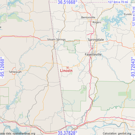
Lincoln GPS coordinates[2]
35° 56' 58.308" North, 94° 25' 24.78" West
| Map corner | latitude | longitude |
|---|---|---|
| Upper-left | 36.51668°, | -95.12668° |
| Center: | 35.94953°, | -94.42355° |
| Lower-right: | 35.37828°, | -93.72043° |
| Map W x H: | 126.6×126.6 km | = 78.7×78.7mi |
| max Lat: | 71.29058° ⇑70.7% North |
| Lincoln: | 35.94953° |
| min Lat: | ⇓29.3% South 19.06759° |
| min Long | Lincoln | max Long |
| -171.73463° | -94.42355° | -66.98998° |
| W 30.3%⇐ | ⇒69.7% E |
Elevation
Elevation of Lincoln is 451 m = 1480 ft, and this is 156.2 m = 512 ft above average elevation for this country.
| Max E: |
3189 m = 10463 ft | 13.6% |
| Lincoln | 451 m 1480 ft | |
| Avg. | 294.8 m = 967 ft | |
Min E: |
-60 m = -197 ft | 86.4% |
See also: United States elevation on elevation.city.
Geographical zone
Lincoln is located in North temperate zone (between Tropic of Cancer and the Arctic Circle). Distance of this Northern Tropic circle is 1391.3 km =864.5 mi to South.| Distance of | km | miles | from Lincoln |
|---|---|---|---|
| North Pole | 6009.8 | 3734.3 | to North |
| Arctic Circle | 3404 | 2115.1 | to North |
| Tropic Cancer | 1391.3 | 864.5 | to South |
| Equator | 3997.2 | 2483.7 | to South |


Nearby cities:
15 places around Lincoln: (largest is in red/bold)
• Bell
29.2 km =18.1 mi,  208°
208°
• Cherry Tree
30.5 km =19 mi,  220°
220°
• Elm Springs
33.2 km =20.6 mi,  30°
30°
• Fairfield
20.5 km =12.7 mi,  236°
236°
• Farmington
18.9 km =11.7 mi,  57°
57°
• Fayetteville
27 km =16.8 mi, 62°
• Greenland
22.9 km =14.2 mi,  77°
77°
• Johnson
30.9 km =19.2 mi,  48°
48°
• Prairie Grove
10 km =6.2 mi,  72°
72°
• Siloam Springs
28.5 km =17.7 mi,  338°
338°
• Stilwell
23.8 km =14.8 mi,  230°
230°
• Tontitown
30.6 km =19 mi, 33°
• West Fork
21.3 km =13.2 mi,  97°
97°
• West Siloam Springs
28.6 km =17.8 mi,  331°
331°
• Westville
13.9 km =8.6 mi,  290°
290°
Sources, notices
• [Note1] Compared only with cities in United States existing in our database
• [Src1] Map data: © OpenStreetMap contributors (CC-BY-SA)
• [Src2] Other city data from geonames.org with taken over terms of usage.
• [Src3] Geographical zone / Annual Mean Temperature by Robert A. Rohde @ Wikipedia
