Carrollton geodata
Carrollton (Illinois) is a seat of a second-order administrative division; located in United States in America/Chicago (GMT-5) time zone. With population of 2,429 people, there are 10783 cities with bigger population in this country. Compared to other cities in United States, 52.2% of cities are located further ↑North; 60.5% of cities are located further →East and 52.2% of cities have higher elevation than Carrollton. Note1
Administrative division(s):
- Level 1: Illinois
- Level 2: Greene County
- Level 3: Township of Carrollton


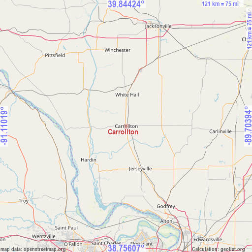
Carrollton GPS coordinates[2]
39° 18' 8.172" North, 90° 24' 25.416" West
| Map corner | latitude | longitude |
|---|---|---|
| Upper-left | 39.84424°, | -91.11019° |
| Center: | 39.30227°, | -90.40706° |
| Lower-right: | 38.75607°, | -89.70394° |
| Map W x H: | 121×121 km | = 75.2×75.2mi |
| max Lat: | 71.29058° ⇑52.2% North |
| Carrollton: | 39.30227° |
| min Lat: | ⇓47.8% South 19.06759° |
| min Long | Carrollton | max Long |
| -171.73463° | -90.40706° | -66.98998° |
| W 39.5%⇐ | ⇒60.5% E |
Elevation
Elevation of Carrollton is 190 m = 623 ft, and this is 104.8 m = 344 ft below average elevation for this country.
| Max E: |
3189 m = 10463 ft | 52.2% |
| Avg. | 294.8 m = 967 ft | |
| Carrollton | 190 m = 623 ft | |
Min E: |
-60 m = -197 ft | 47.8% |
See also: United States elevation on elevation.city.
Geographical zone
Carrollton is located in North temperate zone (between Tropic of Cancer and the Arctic Circle). Distance of this Northern Tropic circle is 1764.1 km =1096.2 mi to South.| Distance of | km | miles | from Carrollton |
|---|---|---|---|
| North Pole | 5637.1 | 3502.7 | to North |
| Arctic Circle | 3031.2 | 1883.5 | to North |
| Tropic Cancer | 1764.1 | 1096.2 | to South |
| Equator | 4370 | 2715.4 | to South |


Nearby cities:
15 places around Carrollton: (largest is in red/bold)
• Brighton
37.1 km =23.1 mi,  141°
141°
• Elsah
38.7 km =24 mi,  173°
173°
• Elsberry
35.6 km =22.1 mi,  244°
244°
• Godfrey
43 km =26.7 mi,  153°
153°
• Grafton
37 km =23 mi,  183°
183°
• Greenfield
17.3 km =10.7 mi,  74°
74°
• Hardin
24.3 km =15.1 mi,  228°
228°
• Jerseyville
21.4 km =13.3 mi,  161°
161°
• Murrayville
34.2 km =21.3 mi,  22°
22°
• Palmyra
38.3 km =23.8 mi, 67°
• Roodhouse
20.4 km =12.7 mi,  8°
8°
• Shipman
37.4 km =23.2 mi,  123°
123°
• White Hall
15 km =9.3 mi,  1°
1°
• Winchester
36.7 km =22.8 mi,  353°
353°
• Woodson
39.7 km =24.7 mi, 23°
Sources, notices
• [Note1] Compared only with cities in United States existing in our database
• [Src1] Map data: © OpenStreetMap contributors (CC-BY-SA)
• [Src2] Other city data from geonames.org with taken over terms of usage.
• [Src3] Geographical zone / Annual Mean Temperature by Robert A. Rohde @ Wikipedia
