Elsberry geodata
Elsberry (Missouri) is a populated place; located in United States in America/Chicago (GMT-5) time zone. With population of 1,986 people, there are 11979 cities with bigger population in this country. Compared to other cities in United States, 53.3% of cities are located further ↑North; 61.6% of cities are located further →East and 63.1% of cities have higher elevation than Elsberry. Note1
Administrative division(s):
- Level 1: Missouri
- Level 2: Lincoln County
- Level 3: Township of Hurricane


Elsberry GPS coordinates[2]
39° 10' 0.192" North, 90° 46' 51.456" West
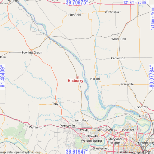
| Map corner | latitude | longitude |
|---|---|---|
| Upper-left | 39.70975°, | -91.48409° |
| Center: | 39.16672°, | -90.78096° |
| Lower-right: | 38.61947°, | -90.07784° |
| Map W x H: | 121.2×121.2 km | = 75.3×75.3mi |
| max Lat: | 71.29058° ⇑53.3% North |
| Elsberry: | 39.16672° |
| min Lat: | ⇓46.7% South 19.06759° |
| min Long | Elsberry | max Long |
| -171.73463° | -90.78096° | -66.98998° |
| W 38.4%⇐ | ⇒61.6% E |
Elevation
Elevation of Elsberry is 138 m = 453 ft, and this is 156.8 m = 514 ft below average elevation for this country.
| Max E: |
3189 m = 10463 ft | 63.1% |
| Avg. | 294.8 m = 967 ft | |
| Elsberry | 138 m = 453 ft | |
Min E: |
-60 m = -197 ft | 36.9% |
See also: United States elevation on elevation.city.
Geographical zone
Elsberry is located in North temperate zone (between Tropic of Cancer and the Arctic Circle). Distance of this Northern Tropic circle is 1749 km =1086.8 mi to South.| Distance of | km | miles | from Elsberry |
|---|---|---|---|
| North Pole | 5652.1 | 3512.1 | to North |
| Arctic Circle | 3046.2 | 1892.8 | to North |
| Tropic Cancer | 1749 | 1086.8 | to South |
| Equator | 4354.9 | 2706 | to South |


Nearby cities:
15 places around Elsberry: (largest is in red/bold)
• Carrollton
35.6 km =22.1 mi,  64°
64°
• Eolia
21 km =13 mi,  291°
291°
• Flint Hill
35.3 km =21.9 mi,  191°
191°
• Grafton
37.3 km =23.2 mi,  125°
125°
• Hardin
14.1 km =8.8 mi,  94°
94°
• Hawk Point
37.3 km =23.2 mi,  234°
234°
• Jerseyville
39.4 km =24.5 mi,  97°
97°
• Louisiana
39.1 km =24.3 mi,  323°
323°
• Moscow Mills
27.1 km =16.8 mi,  205°
205°
• O'Fallon
40.2 km =25 mi,  169°
169°
• Pleasant Hill
31.8 km =19.8 mi,  345°
345°
• Saint Paul
34.1 km =21.2 mi, 174°
• Troy
27 km =16.8 mi,  219°
219°
• Wentzville
40 km =24.9 mi, 188°
• Winfield
19.2 km =11.9 mi, 168°
Sources, notices
• [Note1] Compared only with cities in United States existing in our database
• [Src1] Map data: © OpenStreetMap contributors (CC-BY-SA)
• [Src2] Other city data from geonames.org with taken over terms of usage.
• [Src3] Geographical zone / Annual Mean Temperature by Robert A. Rohde @ Wikipedia
