Wellington geodata
Wellington (Kansas) is a seat of a second-order administrative division; located in United States in America/Chicago (GMT-5) time zone. With population of 7,987 people, there are 5286 cities with bigger population in this country. Compared to other cities in United States, 65% of cities are located further ↑North; 76.8% of cities are located further →East and 82.3% of cities have lower elevation than Wellington. Note1


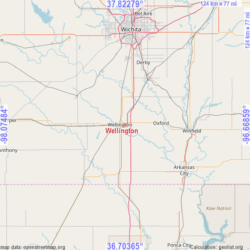
Wellington GPS coordinates[2]
37° 15' 55.08" North, 97° 22' 18.156" West
| Map corner | latitude | longitude |
|---|---|---|
| Upper-left | 37.82279°, | -98.07484° |
| Center: | 37.2653°, | -97.37171° |
| Lower-right: | 36.70365°, | -96.66859° |
| Map W x H: | 124.4×124.4 km | = 77.3×77.3mi |
| max Lat: | 71.29058° ⇑65% North |
| Wellington: | 37.2653° |
| min Lat: | ⇓35% South 19.06759° |
| min Long | Wellington | max Long |
| -171.73463° | -97.37171° | -66.98998° |
| W 23.2%⇐ | ⇒76.8% E |
Elevation
Elevation of Wellington is 380 m = 1247 ft, and this is 85.2 m = 280 ft above average elevation for this country.
| Max E: |
3189 m = 10463 ft | 17.7% |
| Wellington | 380 m 1247 ft | |
| Avg. | 294.8 m = 967 ft | |
Min E: |
-60 m = -197 ft | 82.3% |
See also: United States elevation on elevation.city.
Geographical zone
Wellington is located in North temperate zone (between Tropic of Cancer and the Arctic Circle). Distance of this Northern Tropic circle is 1537.6 km =955.4 mi to South.| Distance of | km | miles | from Wellington |
|---|---|---|---|
| North Pole | 5863.5 | 3643.4 | to North |
| Arctic Circle | 3257.7 | 2024.2 | to North |
| Tropic Cancer | 1537.6 | 955.4 | to South |
| Equator | 4143.5 | 2574.7 | to South |


Nearby cities:
15 places around Wellington: (largest is in red/bold)
• Arkansas City
37.2 km =23.1 mi,  127°
127°
• Belle Plaine
16.4 km =10.2 mi,  29°
29°
• Caldwell
33.3 km =20.7 mi,  218°
218°
• Clearwater
28.9 km =18 mi,  336°
336°
• Conway Springs
27.7 km =17.2 mi,  300°
300°
• Derby
32.5 km =20.2 mi,  16°
16°
• Douglass
42.5 km =26.4 mi,  48°
48°
• Goddard
47.4 km =29.5 mi, 337°
• Haysville
33.3 km =20.7 mi,  2°
2°
• McConnell AFB
41.8 km =26 mi,  13°
13°
• Mulvane
25.9 km =16.1 mi, 25°
• Oxford
18 km =11.2 mi,  86°
86°
• Rose Hill
38.7 km =24 mi, 32°
• Udall
26.5 km =16.5 mi,  59°
59°
• Winfield
33.4 km =20.8 mi, 94°
Sources, notices
• [Note1] Compared only with cities in United States existing in our database
• [Src1] Map data: © OpenStreetMap contributors (CC-BY-SA)
• [Src2] Other city data from geonames.org with taken over terms of usage.
• [Src3] Geographical zone / Annual Mean Temperature by Robert A. Rohde @ Wikipedia
