Longville geodata
Longville (Louisiana) is a populated place; located in United States in America/Chicago (GMT-5) time zone. With population of 635 people, there are 19313 cities with bigger population in this country. Compared to other cities in United States, 91.5% of cities are located further ↑North; 66.8% of cities are located further →East and 80.9% of cities have higher elevation than Longville. Note1


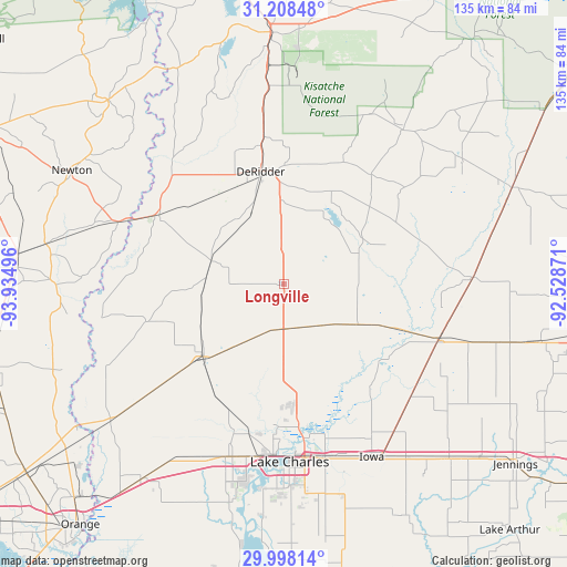
Longville GPS coordinates[2]
30° 36' 18.72" North, 93° 13' 54.588" West
| Map corner | latitude | longitude |
|---|---|---|
| Upper-left | 31.20848°, | -93.93496° |
| Center: | 30.6052°, | -93.23183° |
| Lower-right: | 29.99814°, | -92.52871° |
| Map W x H: | 134.6×134.6 km | = 83.6×83.6mi |
| max Lat: | 71.29058° ⇑91.5% North |
| Longville: | 30.6052° |
| min Lat: | ⇓8.5% South 19.06759° |
| min Long | Longville | max Long |
| -171.73463° | -93.23183° | -66.98998° |
| W 33.2%⇐ | ⇒66.8% E |
Elevation
Elevation of Longville is 43 m = 141 ft, and this is 251.8 m = 826 ft below average elevation for this country.
| Max E: |
3189 m = 10463 ft | 80.9% |
| Avg. | 294.8 m = 967 ft | |
| Longville | 43 m = 141 ft | |
Min E: |
-60 m = -197 ft | 19.1% |
See also: United States elevation on elevation.city.
Geographical zone
Longville is located in North temperate zone (between Tropic of Cancer and the Arctic Circle). Distance of this Northern Tropic circle is 797.1 km =495.3 mi to South.| Distance of | km | miles | from Longville |
|---|---|---|---|
| North Pole | 6604.1 | 4103.6 | to North |
| Arctic Circle | 3998.2 | 2484.4 | to North |
| Tropic Cancer | 797.1 | 495.3 | to South |
| Equator | 3403 | 2114.5 | to South |


Nearby cities:
15 places around Longville: (largest is in red/bold)
• DeQuincy
25.8 km =16 mi,  228°
228°
• DeRidder
27.4 km =17 mi,  348°
348°
• Fort Polk South
49.6 km =30.8 mi,  1°
1°
• Gillis
25.9 km =16.1 mi,  173°
173°
• Iowa
46 km =28.6 mi,  152°
152°
• Kinder
38.8 km =24.1 mi,  110°
110°
• Lake Charles
43.7 km =27.2 mi,  176°
176°
• Merryville
33.9 km =21.1 mi,  299°
299°
• Moss Bluff
33.9 km =21.1 mi, 173°
• Oberlin
44.9 km =27.9 mi,  87°
87°
• Pitkin
46.4 km =28.8 mi,  37°
37°
• Prien
47.2 km =29.3 mi, 184°
• Rosepine
35.3 km =21.9 mi, 352°
• Sulphur
43.3 km =26.9 mi,  198°
198°
• Westlake
40.4 km =25.1 mi, 182°
Sources, notices
• [Note1] Compared only with cities in United States existing in our database
• [Src1] Map data: © OpenStreetMap contributors (CC-BY-SA)
• [Src2] Other city data from geonames.org with taken over terms of usage.
• [Src3] Geographical zone / Annual Mean Temperature by Robert A. Rohde @ Wikipedia
