Oberlin geodata
Oberlin (Louisiana) is a seat of a second-order administrative division; located in United States in America/Chicago (GMT-5) time zone. With population of 1,752 people, there are 12732 cities with bigger population in this country. Compared to other cities in United States, 91.4% of cities are located further ↑North; 65.8% of cities are located further →East and 86.6% of cities have higher elevation than Oberlin. Note1


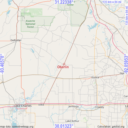
Oberlin GPS coordinates[2]
30° 37' 12.72" North, 92° 45' 45.54" West
| Map corner | latitude | longitude |
|---|---|---|
| Upper-left | 31.22338°, | -93.46578° |
| Center: | 30.6202°, | -92.76265° |
| Lower-right: | 30.01323°, | -92.05953° |
| Map W x H: | 134.6×134.6 km | = 83.6×83.6mi |
| max Lat: | 71.29058° ⇑91.4% North |
| Oberlin: | 30.6202° |
| min Lat: | ⇓8.6% South 19.06759° |
| min Long | Oberlin | max Long |
| -171.73463° | -92.76265° | -66.98998° |
| W 34.2%⇐ | ⇒65.8% E |
Elevation
Elevation of Oberlin is 24 m = 79 ft, and this is 270.8 m = 888 ft below average elevation for this country.
| Max E: |
3189 m = 10463 ft | 86.6% |
| Avg. | 294.8 m = 967 ft | |
| Oberlin | 24 m = 79 ft | |
Min E: |
-60 m = -197 ft | 13.4% |
See also: United States elevation on elevation.city.
Geographical zone
Oberlin is located in North temperate zone (between Tropic of Cancer and the Arctic Circle). Distance of this Northern Tropic circle is 798.7 km =496.3 mi to South.| Distance of | km | miles | from Oberlin |
|---|---|---|---|
| North Pole | 6602.4 | 4102.5 | to North |
| Arctic Circle | 3996.5 | 2483.3 | to North |
| Tropic Cancer | 798.7 | 496.3 | to South |
| Equator | 3404.6 | 2115.5 | to South |


Nearby cities:
15 places around Oberlin: (largest is in red/bold)
• Basile
21.9 km =13.6 mi,  133°
133°
• Elizabeth
27.8 km =17.3 mi,  354°
354°
• Elton
16.7 km =10.4 mi,  157°
157°
• Eunice
35.9 km =22.3 mi,  112°
112°
• Glenmora
43.1 km =26.8 mi,  23°
23°
• Iota
41.1 km =25.5 mi,  141°
141°
• Kinder
17.2 km =10.7 mi,  209°
209°
• Longville
44.9 km =27.9 mi,  267°
267°
• Mamou
32.9 km =20.4 mi,  87°
87°
• Oakdale
23.9 km =14.9 mi, 24°
• Pine Prairie
37 km =23 mi,  60°
60°
• Pitkin
38.9 km =24.2 mi,  334°
334°
• Reddell
32.7 km =20.3 mi,  79°
79°
• Roanoke
42.6 km =26.5 mi,  177°
177°
• Welsh
43.1 km =26.8 mi,  187°
187°
Sources, notices
• [Note1] Compared only with cities in United States existing in our database
• [Src1] Map data: © OpenStreetMap contributors (CC-BY-SA)
• [Src2] Other city data from geonames.org with taken over terms of usage.
• [Src3] Geographical zone / Annual Mean Temperature by Robert A. Rohde @ Wikipedia
