Cottleville geodata
Cottleville (Missouri) is a populated place; located in United States in America/Chicago (GMT-5) time zone. With population of 4,723 people, there are 7416 cities with bigger population in this country. Compared to other cities in United States, 57% of cities are located further ↑North; 61.3% of cities are located further →East and 59% of cities have higher elevation than Cottleville. Note1
Administrative division(s):
- Level 1: Missouri
- Level 2: Saint Charles County
- Level 3: Township of Dardenne


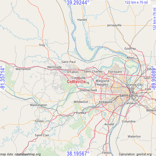
Cottleville GPS coordinates[2]
38° 44' 46.176" North, 90° 39' 14.436" West
| Map corner | latitude | longitude |
|---|---|---|
| Upper-left | 39.29244°, | -91.35714° |
| Center: | 38.74616°, | -90.65401° |
| Lower-right: | 38.19567°, | -89.95089° |
| Map W x H: | 121.9×121.9 km | = 75.7×75.7mi |
| max Lat: | 71.29058° ⇑57% North |
| Cottleville: | 38.74616° |
| min Lat: | ⇓43% South 19.06759° |
| min Long | Cottleville | max Long |
| -171.73463° | -90.65401° | -66.98998° |
| W 38.7%⇐ | ⇒61.3% E |
Elevation
Elevation of Cottleville is 160 m = 525 ft, and this is 134.8 m = 442 ft below average elevation for this country.
| Max E: |
3189 m = 10463 ft | 59% |
| Avg. | 294.8 m = 967 ft | |
| Cottleville | 160 m = 525 ft | |
Min E: |
-60 m = -197 ft | 41% |
See also: United States elevation on elevation.city.
Geographical zone
Cottleville is located in North temperate zone (between Tropic of Cancer and the Arctic Circle). Distance of this Northern Tropic circle is 1702.3 km =1057.8 mi to South.| Distance of | km | miles | from Cottleville |
|---|---|---|---|
| North Pole | 5698.9 | 3541.1 | to North |
| Arctic Circle | 3093 | 1921.9 | to North |
| Tropic Cancer | 1702.3 | 1057.8 | to South |
| Equator | 4308.2 | 2677 | to South |


Nearby cities:
15 places around Cottleville: (largest is in red/bold)
• Ballwin
19.2 km =11.9 mi,  150°
150°
• Chesterfield
11.4 km =7.1 mi,  144°
144°
• Clarkson Valley
15.3 km =9.5 mi,  158°
158°
• Dardenne Prairie
7 km =4.3 mi,  291°
291°
• Ellisville
18 km =11.2 mi, 161°
• Lake Saint Louis
12.8 km =8 mi,  296°
296°
• Maryland Heights
19.8 km =12.3 mi,  100°
100°
• O'Fallon
8.2 km =5.1 mi,  330°
330°
• Saint Charles
15.6 km =9.7 mi,  74°
74°
• Saint Paul
14.9 km =9.3 mi, 329°
• Saint Peters
6.5 km =4 mi,  21°
21°
• Weldon Spring
4.8 km =3 mi,  220°
220°
• Wentzville
18.7 km =11.6 mi, 292°
• Wildwood
18.2 km =11.3 mi,  182°
182°
• Winchester
20.5 km =12.7 mi, 147°
Sources, notices
• [Note1] Compared only with cities in United States existing in our database
• [Src1] Map data: © OpenStreetMap contributors (CC-BY-SA)
• [Src2] Other city data from geonames.org with taken over terms of usage.
• [Src3] Geographical zone / Annual Mean Temperature by Robert A. Rohde @ Wikipedia
