O'Fallon geodata
O'Fallon (Missouri) is a populated place; located in United States in America/Chicago (GMT-5) time zone. With population of 85,040 people, there are 455 cities with bigger population in this country. Compared to other cities in United States, 56.5% of cities are located further ↑North; 61.4% of cities are located further →East and 58.2% of cities have higher elevation than O'Fallon. Note1
Administrative division(s):
- Level 1: Missouri
- Level 2: Saint Charles County
- Level 3: Township of O'Fallon


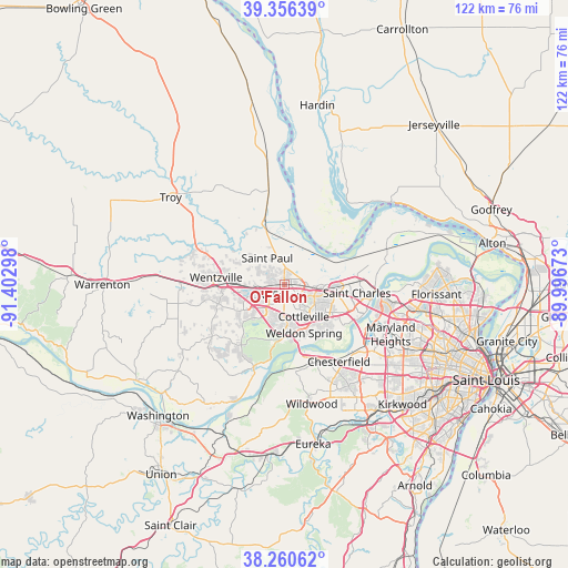
O'Fallon GPS coordinates[2]
38° 48' 38.196" North, 90° 41' 59.46" West
| Map corner | latitude | longitude |
|---|---|---|
| Upper-left | 39.35639°, | -91.40298° |
| Center: | 38.81061°, | -90.69985° |
| Lower-right: | 38.26062°, | -89.99673° |
| Map W x H: | 121.8×121.8 km | = 75.7×75.7mi |
| max Lat: | 71.29058° ⇑56.5% North |
| O'Fallon: | 38.81061° |
| min Lat: | ⇓43.5% South 19.06759° |
| min Long | O'Fallon | max Long |
| -171.73463° | -90.69985° | -66.98998° |
| W 38.6%⇐ | ⇒61.4% E |
Elevation
Elevation of O'Fallon is 164 m = 538 ft, and this is 130.8 m = 429 ft below average elevation for this country.
| Max E: |
3189 m = 10463 ft | 58.2% |
| Avg. | 294.8 m = 967 ft | |
| O'Fallon | 164 m = 538 ft | |
Min E: |
-60 m = -197 ft | 41.8% |
See also: O'Fallon elevation on elevation.city.
Geographical zone
O'Fallon is located in North temperate zone (between Tropic of Cancer and the Arctic Circle). Distance of this Northern Tropic circle is 1709.4 km =1062.2 mi to South.| Distance of | km | miles | from O'Fallon |
|---|---|---|---|
| North Pole | 5691.7 | 3536.7 | to North |
| Arctic Circle | 3085.8 | 1917.4 | to North |
| Tropic Cancer | 1709.4 | 1062.2 | to South |
| Equator | 4315.3 | 2681.4 | to South |


Nearby cities:
15 places around O'Fallon: (largest is in red/bold)
• Bridgeton
25.5 km =15.8 mi,  100°
100°
• Chesterfield
19.6 km =12.2 mi,  147°
147°
• Clarkson Valley
23.4 km =14.5 mi,  155°
155°
• Cottleville
8.2 km =5.1 mi, 150°
• Dardenne Prairie
5.2 km =3.2 mi,  208°
208°
• Flint Hill
14.8 km =9.2 mi,  289°
289°
• Foristell
22.2 km =13.8 mi,  271°
271°
• Lake Saint Louis
7.6 km =4.7 mi,  258°
258°
• Moscow Mills
24.3 km =15.1 mi,  308°
308°
• Saint Charles
19.2 km =11.9 mi, 98°
• Saint Paul
6.7 km =4.2 mi,  327°
327°
• Saint Peters
6.5 km =4 mi, 100°
• Weldon Spring
10.8 km =6.7 mi,  175°
175°
• Wentzville
13.3 km =8.3 mi, 270°
• Winfield
21 km =13 mi,  350°
350°
Sources, notices
• [Note1] Compared only with cities in United States existing in our database
• [Src1] Map data: © OpenStreetMap contributors (CC-BY-SA)
• [Src2] Other city data from geonames.org with taken over terms of usage.
• [Src3] Geographical zone / Annual Mean Temperature by Robert A. Rohde @ Wikipedia
