Hot Springs geodata
Hot Springs (North Carolina) is a populated place; located in United States in America/New_York (GMT-4) time zone. With population of 562 people, there are 20130 cities with bigger population in this country. Compared to other cities in United States, 70.9% of cities are located further ↑North; 62.5% of cities are located further ←West and 84.6% of cities have lower elevation than Hot Springs. Note1


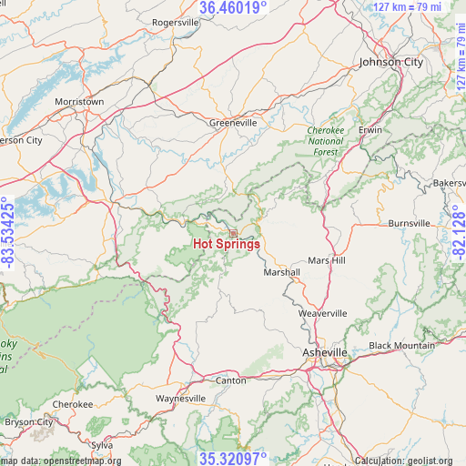
Hot Springs GPS coordinates[2]
35° 53' 33.468" North, 82° 49' 52.032" West
| Map corner | latitude | longitude |
|---|---|---|
| Upper-left | 36.46019°, | -83.53425° |
| Center: | 35.89263°, | -82.83112° |
| Lower-right: | 35.32097°, | -82.128° |
| Map W x H: | 126.7×126.7 km | = 78.7×78.7mi |
| max Lat: | 71.29058° ⇑70.9% North |
| Hot Springs: | 35.89263° |
| min Lat: | ⇓29.1% South 19.06759° |
| min Long | Hot Springs | max Long |
| -171.73463° | -82.83112° | -66.98998° |
| W 62.5%⇐ | ⇒37.5% E |
Elevation
Elevation of Hot Springs is 416 m = 1365 ft, and this is 121.2 m = 398 ft above average elevation for this country.
| Max E: |
3189 m = 10463 ft | 15.4% |
| Hot Springs | 416 m 1365 ft | |
| Avg. | 294.8 m = 967 ft | |
Min E: |
-60 m = -197 ft | 84.6% |
See also: United States elevation on elevation.city.
Geographical zone
Hot Springs is located in North temperate zone (between Tropic of Cancer and the Arctic Circle). Distance of this Northern Tropic circle is 1385 km =860.6 mi to South.| Distance of | km | miles | from Hot Springs |
|---|---|---|---|
| North Pole | 6016.2 | 3738.3 | to North |
| Arctic Circle | 3410.3 | 2119.1 | to North |
| Tropic Cancer | 1385 | 860.6 | to South |
| Equator | 3990.9 | 2479.8 | to South |


Nearby cities:
15 places around Hot Springs: (largest is in red/bold)
• Asheville
41 km =25.5 mi,  142°
142°
• Banner Hill
45.1 km =28 mi,  54°
54°
• Canton
40 km =24.9 mi,  180°
180°
• Clyde
40.6 km =25.2 mi,  190°
190°
• Cove Creek
35.7 km =22.2 mi,  207°
207°
• Greeneville
30.1 km =18.7 mi,  0°
0°
• Lake Junaluska
42.2 km =26.2 mi,  195°
195°
• Mars Hill
26.4 km =16.4 mi,  106°
106°
• Marshall
17 km =10.6 mi,  128°
128°
• Mosheim
34.9 km =21.7 mi,  340°
340°
• Newport
33.1 km =20.6 mi,  284°
284°
• Tusculum
32.1 km =19.9 mi,  11°
11°
• Weaverville
32.7 km =20.3 mi, 131°
• West Canton
39.5 km =24.5 mi, 183°
• Woodfin
36.5 km =22.7 mi, 142°
Sources, notices
• [Note1] Compared only with cities in United States existing in our database
• [Src1] Map data: © OpenStreetMap contributors (CC-BY-SA)
• [Src2] Other city data from geonames.org with taken over terms of usage.
• [Src3] Geographical zone / Annual Mean Temperature by Robert A. Rohde @ Wikipedia
