Bean Station geodata
Bean Station (Tennessee) is a populated place; located in United States in America/New_York (GMT-4) time zone. With population of 3,104 people, there are 9453 cities with bigger population in this country. Compared to other cities in United States, 68.7% of cities are located further ↑North; 61.2% of cities are located further ←West and 79.8% of cities have lower elevation than Bean Station. Note1


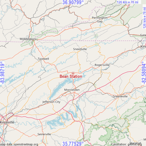
Bean Station GPS coordinates[2]
36° 20' 37.32" North, 83° 17' 2.616" West
| Map corner | latitude | longitude |
|---|---|---|
| Upper-left | 36.90799°, | -83.98719° |
| Center: | 36.3437°, | -83.28406° |
| Lower-right: | 35.77529°, | -82.58094° |
| Map W x H: | 125.9×125.9 km | = 78.2×78.2mi |
| max Lat: | 71.29058° ⇑68.7% North |
| Bean Station: | 36.3437° |
| min Lat: | ⇓31.3% South 19.06759° |
| min Long | Bean Station | max Long |
| -171.73463° | -83.28406° | -66.98998° |
| W 61.2%⇐ | ⇒38.8% E |
Elevation
Elevation of Bean Station is 351 m = 1152 ft, and this is 56.2 m = 184 ft above average elevation for this country.
| Max E: |
3189 m = 10463 ft | 20.2% |
| Bean Station | 351 m 1152 ft | |
| Avg. | 294.8 m = 967 ft | |
Min E: |
-60 m = -197 ft | 79.8% |
See also: United States elevation on elevation.city.
Geographical zone
Bean Station is located in North temperate zone (between Tropic of Cancer and the Arctic Circle). Distance of this Northern Tropic circle is 1435.1 km =891.7 mi to South.| Distance of | km | miles | from Bean Station |
|---|---|---|---|
| North Pole | 5966 | 3707.1 | to North |
| Arctic Circle | 3360.1 | 2087.9 | to North |
| Tropic Cancer | 1435.1 | 891.7 | to South |
| Equator | 4041 | 2511 | to South |


Nearby cities:
15 places around Bean Station: (largest is in red/bold)
• Bulls Gap
20.2 km =12.6 mi,  118°
118°
• Dandridge
38.3 km =23.8 mi,  197°
197°
• Jefferson City
30.9 km =19.2 mi,  217°
217°
• Mooresburg
5 km =3.1 mi,  86°
86°
• Morristown
14.5 km =9 mi,  183°
183°
• Mosheim
33.8 km =21 mi, 120°
• New Market
35.9 km =22.3 mi, 222°
• New Tazewell
30.3 km =18.8 mi,  291°
291°
• Rogersville
25.9 km =16.1 mi,  74°
74°
• Rose Hill
37.2 km =23.1 mi,  348°
348°
• Rutledge
21.8 km =13.5 mi,  251°
251°
• Sneedville
21.5 km =13.4 mi,  16°
16°
• Surgoinsville
41.2 km =25.6 mi, 69°
• Tazewell
28.3 km =17.6 mi,  295°
295°
• White Pine
26.3 km =16.3 mi, 180°
Sources, notices
• [Note1] Compared only with cities in United States existing in our database
• [Src1] Map data: © OpenStreetMap contributors (CC-BY-SA)
• [Src2] Other city data from geonames.org with taken over terms of usage.
• [Src3] Geographical zone / Annual Mean Temperature by Robert A. Rohde @ Wikipedia
