Jefferson City geodata
Jefferson City (Tennessee) is a populated place; located in United States in America/New_York (GMT-4) time zone. With population of 8,504 people, there are 5017 cities with bigger population in this country. Compared to other cities in United States, 69.8% of cities are located further ↑North; 60.6% of cities are located further ←West and 81.6% of cities have lower elevation than Jefferson City. Note1


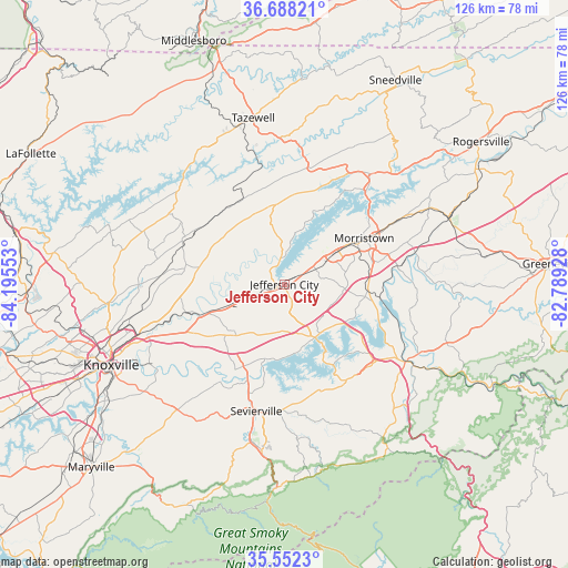
Jefferson City GPS coordinates[2]
36° 7' 20.316" North, 83° 29' 32.64" West
| Map corner | latitude | longitude |
|---|---|---|
| Upper-left | 36.68821°, | -84.19553° |
| Center: | 36.12231°, | -83.4924° |
| Lower-right: | 35.5523°, | -82.78928° |
| Map W x H: | 126.3×126.3 km | = 78.5×78.5mi |
| max Lat: | 71.29058° ⇑69.8% North |
| Jefferson City: | 36.12231° |
| min Lat: | ⇓30.2% South 19.06759° |
| min Long | Jefferson City | max Long |
| -171.73463° | -83.4924° | -66.98998° |
| W 60.6%⇐ | ⇒39.4% E |
Elevation
Elevation of Jefferson City is 371 m = 1217 ft, and this is 76.2 m = 250 ft above average elevation for this country.
| Max E: |
3189 m = 10463 ft | 18.4% |
| Jefferson City | 371 m 1217 ft | |
| Avg. | 294.8 m = 967 ft | |
Min E: |
-60 m = -197 ft | 81.6% |
See also: United States elevation on elevation.city.
Geographical zone
Jefferson City is located in North temperate zone (between Tropic of Cancer and the Arctic Circle). Distance of this Northern Tropic circle is 1410.5 km =876.4 mi to South.| Distance of | km | miles | from Jefferson City |
|---|---|---|---|
| North Pole | 5990.6 | 3722.4 | to North |
| Arctic Circle | 3384.7 | 2103.2 | to North |
| Tropic Cancer | 1410.5 | 876.4 | to South |
| Equator | 4016.4 | 2495.7 | to South |


Nearby cities:
15 places around Jefferson City: (largest is in red/bold)
• Bean Station
30.9 km =19.2 mi,  37°
37°
• Blaine
19.3 km =12 mi,  280°
280°
• Condon
27.8 km =17.3 mi, 283°
• Dandridge
13.8 km =8.6 mi,  149°
149°
• Fair Garden
25.5 km =15.8 mi,  163°
163°
• Luttrell
24 km =14.9 mi,  290°
290°
• Mascot
23.8 km =14.8 mi,  253°
253°
• Maynardville
30.9 km =19.2 mi,  297°
297°
• Morristown
20.5 km =12.7 mi,  60°
60°
• New Market
5.8 km =3.6 mi, 249°
• Newport
32.4 km =20.1 mi,  122°
122°
• Plainview
27.9 km =17.3 mi, 282°
• Rutledge
17.8 km =11.1 mi,  353°
353°
• Sevierville
28.9 km =18 mi,  192°
192°
• White Pine
18.5 km =11.5 mi,  95°
95°
Sources, notices
• [Note1] Compared only with cities in United States existing in our database
• [Src1] Map data: © OpenStreetMap contributors (CC-BY-SA)
• [Src2] Other city data from geonames.org with taken over terms of usage.
• [Src3] Geographical zone / Annual Mean Temperature by Robert A. Rohde @ Wikipedia
