Gatesville geodata
Gatesville (Texas) is a seat of a second-order administrative division; located in United States in America/Chicago (GMT-5) time zone. With population of 15,724 people, there are 3110 cities with bigger population in this country. Compared to other cities in United States, 89.8% of cities are located further ↑North; 77.8% of cities are located further →East and 62.8% of cities have lower elevation than Gatesville. Note1


Gatesville GPS coordinates[2]
31° 26' 6.576" North, 97° 44' 38.076" West
| Map corner | latitude | longitude |
|---|---|---|
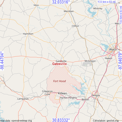
| Upper-left | 32.03316°, | -98.44704° |
| Center: | 31.43516°, | -97.74391° |
| Lower-right: | 30.83332°, | -97.04079° |
| Map W x H: | 133.4×133.4 km | = 82.9×82.9mi |
| max Lat: | 71.29058° ⇑89.8% North |
| Gatesville: | 31.43516° |
| min Lat: | ⇓10.2% South 19.06759° |
| min Long | Gatesville | max Long |
| -171.73463° | -97.74391° | -66.98998° |
| W 22.2%⇐ | ⇒77.8% E |
Elevation
Elevation of Gatesville is 252 m = 827 ft, and this is 42.8 m = 140 ft below average elevation for this country.
| Max E: |
3189 m = 10463 ft | 37.2% |
| Avg. | 294.8 m = 967 ft | |
| Gatesville | 252 m = 827 ft | |
Min E: |
-60 m = -197 ft | 62.8% |
See also: United States elevation on elevation.city.
Geographical zone
Gatesville is located in North temperate zone (between Tropic of Cancer and the Arctic Circle). Distance of this Northern Tropic circle is 889.3 km =552.6 mi to South.| Distance of | km | miles | from Gatesville |
|---|---|---|---|
| North Pole | 6511.8 | 4046.2 | to North |
| Arctic Circle | 3905.9 | 2427 | to North |
| Tropic Cancer | 889.3 | 552.6 | to South |
| Equator | 3495.3 | 2171.9 | to South |


Nearby cities:
15 places around Gatesville: (largest is in red/bold)
• Ames
10.1 km =6.3 mi,  340°
340°
• Clifton
41.7 km =25.9 mi,  22°
22°
• Copperas Cove
37.8 km =23.5 mi,  203°
203°
• Crawford
30.6 km =19 mi,  68°
68°
• Fort Gates
5.2 km =3.2 mi,  139°
139°
• Fort Hood
33.5 km =20.8 mi,  185°
185°
• Hamilton
46.8 km =29.1 mi,  309°
309°
• Harker Heights
39.9 km =24.8 mi,  168°
168°
• Kempner
46.4 km =28.8 mi,  211°
211°
• Killeen
35.4 km =22 mi,  177°
177°
• McGregor
31.8 km =19.8 mi,  88°
88°
• Moody
39 km =24.2 mi,  111°
111°
• Morgans Point Resort
41.6 km =25.8 mi, 140°
• Nolanville
41.7 km =25.9 mi,  161°
161°
• Valley Mills
35.8 km =22.2 mi,  45°
45°
Sources, notices
• [Note1] Compared only with cities in United States existing in our database
• [Src1] Map data: © OpenStreetMap contributors (CC-BY-SA)
• [Src2] Other city data from geonames.org with taken over terms of usage.
• [Src3] Geographical zone / Annual Mean Temperature by Robert A. Rohde @ Wikipedia
