New Chapel Hill geodata
New Chapel Hill (Texas) is a populated place; located in United States in America/Chicago (GMT-5) time zone. With population of 616 people, there are 19520 cities with bigger population in this country. Compared to other cities in United States, 87.8% of cities are located further ↑North; 71.6% of cities are located further →East and 64.4% of cities have higher elevation than New Chapel Hill. Note1


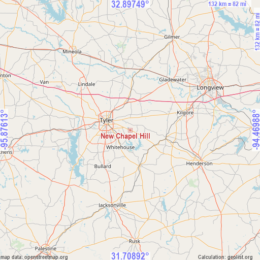
New Chapel Hill GPS coordinates[2]
32° 18' 18.54" North, 95° 10' 22.8" West
| Map corner | latitude | longitude |
|---|---|---|
| Upper-left | 32.89749°, | -95.87613° |
| Center: | 32.30515°, | -95.173° |
| Lower-right: | 31.70892°, | -94.46988° |
| Map W x H: | 132.2×132.2 km | = 82.1×82.1mi |
| max Lat: | 71.29058° ⇑87.8% North |
| New Chapel Hill: | 32.30515° |
| min Lat: | ⇓12.2% South 19.06759° |
| min Long | New Chapel Hill | max Long |
| -171.73463° | -95.173° | -66.98998° |
| W 28.4%⇐ | ⇒71.6% E |
Elevation
Elevation of New Chapel Hill is 131 m = 430 ft, and this is 163.8 m = 537 ft below average elevation for this country.
| Max E: |
3189 m = 10463 ft | 64.4% |
| Avg. | 294.8 m = 967 ft | |
| New Chapel Hill | 131 m = 430 ft | |
Min E: |
-60 m = -197 ft | 35.6% |
See also: United States elevation on elevation.city.
Geographical zone
New Chapel Hill is located in North temperate zone (between Tropic of Cancer and the Arctic Circle). Distance of this Northern Tropic circle is 986.1 km =612.7 mi to South.| Distance of | km | miles | from New Chapel Hill |
|---|---|---|---|
| North Pole | 6415.1 | 3986.2 | to North |
| Arctic Circle | 3809.2 | 2366.9 | to North |
| Tropic Cancer | 986.1 | 612.7 | to South |
| Equator | 3592 | 2232 | to South |


Nearby cities:
15 places around New Chapel Hill: (largest is in red/bold)
• Arp
14 km =8.7 mi,  129°
129°
• Big Sandy
31.6 km =19.6 mi,  10°
10°
• Bullard
23 km =14.3 mi,  217°
217°
• Chandler
28.8 km =17.9 mi,  270°
270°
• Hawkins
31.6 km =19.6 mi,  354°
354°
• Kilgore
29.3 km =18.2 mi,  72°
72°
• Liberty City
26.2 km =16.3 mi,  53°
53°
• Lindale
32.3 km =20.1 mi,  316°
316°
• New London
23.1 km =14.4 mi,  108°
108°
• Noonday
23.2 km =14.4 mi,  250°
250°
• Overton
18.6 km =11.6 mi,  100°
100°
• Troup
18.5 km =11.5 mi,  164°
164°
• Tyler
13.1 km =8.1 mi,  293°
293°
• Whitehouse
10 km =6.2 mi,  209°
209°
• Winona
20.5 km =12.7 mi,  1°
1°
Sources, notices
• [Note1] Compared only with cities in United States existing in our database
• [Src1] Map data: © OpenStreetMap contributors (CC-BY-SA)
• [Src2] Other city data from geonames.org with taken over terms of usage.
• [Src3] Geographical zone / Annual Mean Temperature by Robert A. Rohde @ Wikipedia
