Tyler geodata
Tyler (Texas) is a seat of a second-order administrative division; located in United States in America/Chicago (GMT-5) time zone. With population of 103,700 people, there are 333 cities with bigger population in this country. Compared to other cities in United States, 87.6% of cities are located further ↑North; 71.8% of cities are located further →East and 56.4% of cities have higher elevation than Tyler. Note1


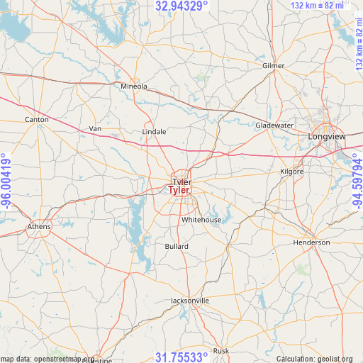
Tyler GPS coordinates[2]
32° 21' 4.536" North, 95° 18' 3.816" West
| Map corner | latitude | longitude |
|---|---|---|
| Upper-left | 32.94329°, | -96.00419° |
| Center: | 32.35126°, | -95.30106° |
| Lower-right: | 31.75533°, | -94.59794° |
| Map W x H: | 132.1×132.1 km | = 82.1×82.1mi |
| max Lat: | 71.29058° ⇑87.6% North |
| Tyler: | 32.35126° |
| min Lat: | ⇓12.4% South 19.06759° |
| min Long | Tyler | max Long |
| -171.73463° | -95.30106° | -66.98998° |
| W 28.2%⇐ | ⇒71.8% E |
Elevation
Elevation of Tyler is 174 m = 571 ft, and this is 120.8 m = 396 ft below average elevation for this country.
| Max E: |
3189 m = 10463 ft | 56.4% |
| Avg. | 294.8 m = 967 ft | |
| Tyler | 174 m = 571 ft | |
Min E: |
-60 m = -197 ft | 43.6% |
See also: Tyler elevation on elevation.city.
Geographical zone
Tyler is located in North temperate zone (between Tropic of Cancer and the Arctic Circle). Distance of this Northern Tropic circle is 991.2 km =615.9 mi to South.| Distance of | km | miles | from Tyler |
|---|---|---|---|
| North Pole | 6409.9 | 3982.9 | to North |
| Arctic Circle | 3804.1 | 2363.8 | to North |
| Tropic Cancer | 991.2 | 615.9 | to South |
| Equator | 3597.1 | 2235.1 | to South |


Nearby cities:
15 places around Tyler: (largest is in red/bold)
• Arp
26.8 km =16.7 mi,  121°
121°
• Berryville
33.3 km =20.7 mi,  208°
208°
• Big Sandy
31.5 km =19.6 mi,  34°
34°
• Brownsboro
29.9 km =18.6 mi,  259°
259°
• Bullard
23.6 km =14.7 mi,  184°
184°
• Chandler
17.5 km =10.9 mi,  254°
254°
• Hawkins
27.9 km =17.3 mi,  19°
19°
• Hideaway
21.3 km =13.2 mi,  316°
316°
• Lindale
20.9 km =13 mi,  330°
330°
• New Chapel Hill
13.1 km =8.1 mi,  113°
113°
• Noonday
16.2 km =10.1 mi,  217°
217°
• Overton
31.5 km =19.6 mi, 105°
• Troup
28.6 km =17.8 mi,  143°
143°
• Whitehouse
15.6 km =9.7 mi,  152°
152°
• Winona
19.9 km =12.4 mi,  39°
39°
Sources, notices
• [Note1] Compared only with cities in United States existing in our database
• [Src1] Map data: © OpenStreetMap contributors (CC-BY-SA)
• [Src2] Other city data from geonames.org with taken over terms of usage.
• [Src3] Geographical zone / Annual Mean Temperature by Robert A. Rohde @ Wikipedia
