Pearsall geodata
Pearsall (Texas) is a seat of a second-order administrative division; located in United States in America/Chicago (GMT-5) time zone. With population of 9,980 people, there are 4470 cities with bigger population in this country. Compared to other cities in United States, 95.4% of cities are located further ↑North; 80% of cities are located further →East and 51.4% of cities have higher elevation than Pearsall. Note1


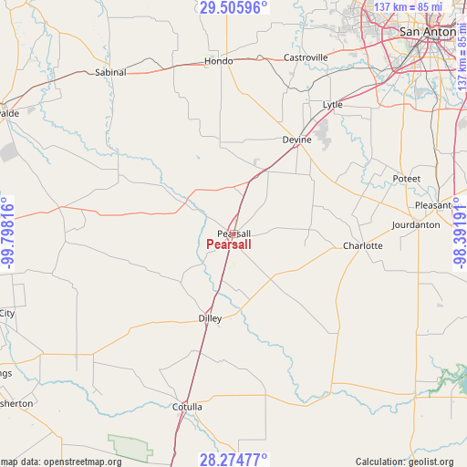
Pearsall GPS coordinates[2]
28° 53' 31.884" North, 99° 5' 42.108" West
| Map corner | latitude | longitude |
|---|---|---|
| Upper-left | 29.50596°, | -99.79816° |
| Center: | 28.89219°, | -99.09503° |
| Lower-right: | 28.27477°, | -98.39191° |
| Map W x H: | 136.9×136.9 km | = 85.1×85.1mi |
| max Lat: | 71.29058° ⇑95.4% North |
| Pearsall: | 28.89219° |
| min Lat: | ⇓4.6% South 19.06759° |
| min Long | Pearsall | max Long |
| -171.73463° | -99.09503° | -66.98998° |
| W 20%⇐ | ⇒80% E |
Elevation
Elevation of Pearsall is 193 m = 633 ft, and this is 101.8 m = 334 ft below average elevation for this country.
| Max E: |
3189 m = 10463 ft | 51.4% |
| Avg. | 294.8 m = 967 ft | |
| Pearsall | 193 m = 633 ft | |
Min E: |
-60 m = -197 ft | 48.6% |
See also: United States elevation on elevation.city.
Geographical zone
Pearsall is located in North temperate zone (between Tropic of Cancer and the Arctic Circle). Distance of this Northern Tropic circle is 606.6 km =376.9 mi to South.| Distance of | km | miles | from Pearsall |
|---|---|---|---|
| North Pole | 6794.6 | 4222 | to North |
| Arctic Circle | 4188.7 | 2602.7 | to North |
| Tropic Cancer | 606.6 | 376.9 | to South |
| Equator | 3212.5 | 1996.2 | to South |


Nearby cities:
15 places around Pearsall: (largest is in red/bold)
• Batesville
51.3 km =31.9 mi,  277°
277°
• Castroville
55.7 km =34.6 mi,  22°
22°
• Charlotte
38 km =23.6 mi,  95°
95°
• Cotulla
52.4 km =32.6 mi,  195°
195°
• D'Hanis
51.9 km =32.2 mi,  339°
339°
• Devine
33.2 km =20.6 mi,  33°
33°
• Dilley
26 km =16.2 mi, 196°
• Gardendale
43.4 km =27 mi, 195°
• Hondo
50.8 km =31.6 mi,  354°
354°
• Jourdanton
53.5 km =33.2 mi,  86°
86°
• La Coste
54.2 km =33.7 mi, 30°
• Lytle
47.8 km =29.7 mi,  37°
37°
• Natalia
40.1 km =24.9 mi, 34°
• North Pearsall
2.5 km =1.6 mi,  356°
356°
• Poteet
53.9 km =33.5 mi,  72°
72°
Sources, notices
• [Note1] Compared only with cities in United States existing in our database
• [Src1] Map data: © OpenStreetMap contributors (CC-BY-SA)
• [Src2] Other city data from geonames.org with taken over terms of usage.
• [Src3] Geographical zone / Annual Mean Temperature by Robert A. Rohde @ Wikipedia
