Pecan Plantation geodata
Pecan Plantation (Texas) is a populated place; located in United States in America/Chicago (GMT-5) time zone. With population of 5,294 people, there are 6914 cities with bigger population in this country. Compared to other cities in United States, 87.6% of cities are located further ↑North; 77.7% of cities are located further →East and 56.4% of cities have lower elevation than Pecan Plantation. Note1


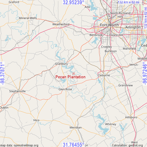
Pecan Plantation GPS coordinates[2]
32° 21' 37.512" North, 97° 40' 32.088" West
| Map corner | latitude | longitude |
|---|---|---|
| Upper-left | 32.95239°, | -98.37871° |
| Center: | 32.36042°, | -97.67558° |
| Lower-right: | 31.76455°, | -96.97246° |
| Map W x H: | 132.1×132.1 km | = 82.1×82.1mi |
| max Lat: | 71.29058° ⇑87.6% North |
| Pecan Plantation: | 32.36042° |
| min Lat: | ⇓12.4% South 19.06759° |
| min Long | Pecan Plantatio | max Long |
| -171.73463° | -97.67558° | -66.98998° |
| W 22.3%⇐ | ⇒77.7% E |
Elevation
Elevation of Pecan Plantation is 224 m = 735 ft, and this is 70.8 m = 232 ft below average elevation for this country.
| Max E: |
3189 m = 10463 ft | 43.6% |
| Avg. | 294.8 m = 967 ft | |
| Pecan Plantation | 224 m = 735 ft | |
Min E: |
-60 m = -197 ft | 56.4% |
See also: United States elevation on elevation.city.
Geographical zone
Pecan Plantation is located in North temperate zone (between Tropic of Cancer and the Arctic Circle). Distance of this Northern Tropic circle is 992.2 km =616.5 mi to South.| Distance of | km | miles | from Pecan Plantation |
|---|---|---|---|
| North Pole | 6408.9 | 3982.3 | to North |
| Arctic Circle | 3803 | 2363.1 | to North |
| Tropic Cancer | 992.2 | 616.5 | to South |
| Equator | 3598.1 | 2235.8 | to South |


Nearby cities:
15 places around Pecan Plantation: (largest is in red/bold)
• Aledo
37.9 km =23.5 mi,  10°
10°
• Annetta South
34.2 km =21.3 mi,  2°
2°
• Cleburne
27.2 km =16.9 mi,  92°
92°
• Cresson
19.9 km =12.4 mi,  15°
15°
• DeCordova
7.9 km =4.9 mi,  346°
346°
• Glen Rose
15.9 km =9.9 mi,  208°
208°
• Godley
17.1 km =10.6 mi,  54°
54°
• Granbury
14.4 km =8.9 mi,  309°
309°
• Joshua
29.2 km =18.1 mi,  67°
67°
• Keene
33.3 km =20.7 mi,  83°
83°
• Oak Trail Shores
20.6 km =12.8 mi, 313°
• Rio Vista
31.6 km =19.6 mi,  116°
116°
• Tolar
23.2 km =14.4 mi,  277°
277°
• Walnut Springs
34.4 km =21.4 mi,  191°
191°
• Western Lake
31.9 km =19.8 mi,  336°
336°
Sources, notices
• [Note1] Compared only with cities in United States existing in our database
• [Src1] Map data: © OpenStreetMap contributors (CC-BY-SA)
• [Src2] Other city data from geonames.org with taken over terms of usage.
• [Src3] Geographical zone / Annual Mean Temperature by Robert A. Rohde @ Wikipedia
