Stamford geodata
Stamford (Texas) is a populated place; located in United States in America/Chicago (GMT-5) time zone. With population of 2,973 people, there are 9677 cities with bigger population in this country. Compared to other cities in United States, 85.4% of cities are located further ↑North; 80.6% of cities are located further →East and 87.8% of cities have lower elevation than Stamford. Note1


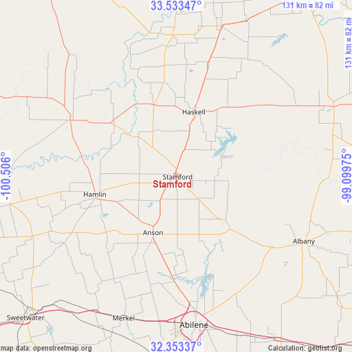
Stamford GPS coordinates[2]
32° 56' 43.404" North, 99° 48' 10.332" West
| Map corner | latitude | longitude |
|---|---|---|
| Upper-left | 33.53347°, | -100.506° |
| Center: | 32.94539°, | -99.80287° |
| Lower-right: | 32.35337°, | -99.09975° |
| Map W x H: | 131.2×131.2 km | = 81.5×81.5mi |
| max Lat: | 71.29058° ⇑85.4% North |
| Stamford: | 32.94539° |
| min Lat: | ⇓14.6% South 19.06759° |
| min Long | Stamford | max Long |
| -171.73463° | -99.80287° | -66.98998° |
| W 19.4%⇐ | ⇒80.6% E |
Elevation
Elevation of Stamford is 497 m = 1631 ft, and this is 202.2 m = 663 ft above average elevation for this country.
| Max E: |
3189 m = 10463 ft | 12.2% |
| Stamford | 497 m 1631 ft | |
| Avg. | 294.8 m = 967 ft | |
Min E: |
-60 m = -197 ft | 87.8% |
See also: United States elevation on elevation.city.
Geographical zone
Stamford is located in North temperate zone (between Tropic of Cancer and the Arctic Circle). Distance of this Northern Tropic circle is 1057.3 km =657 mi to South.| Distance of | km | miles | from Stamford |
|---|---|---|---|
| North Pole | 6343.9 | 3941.9 | to North |
| Arctic Circle | 3738 | 2322.7 | to North |
| Tropic Cancer | 1057.3 | 657 | to South |
| Equator | 3663.2 | 2276.2 | to South |


Nearby cities:
15 places around Stamford: (largest is in red/bold)
• Abilene
55.6 km =34.5 mi,  173°
173°
• Albany
53.3 km =33.1 mi,  117°
117°
• Anson
22.7 km =14.1 mi,  202°
202°
• Aspermont
44.7 km =27.8 mi,  297°
297°
• Hamlin
30.9 km =19.2 mi,  257°
257°
• Haskell
24.5 km =15.2 mi,  15°
15°
• Hawley
37.1 km =23.1 mi,  181°
181°
• Knox City
52.6 km =32.7 mi,  358°
358°
• Merkel
56.3 km =35 mi, 200°
• Munday
58.5 km =36.4 mi, 16°
• Roby
58.1 km =36.1 mi,  247°
247°
• Rotan
62.7 km =39 mi, 260°
• Rule
27.9 km =17.3 mi,  342°
342°
• Throckmorton
63.8 km =39.6 mi,  65°
65°
• Tye
54.6 km =33.9 mi,  186°
186°
Sources, notices
• [Note1] Compared only with cities in United States existing in our database
• [Src1] Map data: © OpenStreetMap contributors (CC-BY-SA)
• [Src2] Other city data from geonames.org with taken over terms of usage.
• [Src3] Geographical zone / Annual Mean Temperature by Robert A. Rohde @ Wikipedia
