Alexis geodata
Alexis (Illinois) is a populated place; located in United States in America/Chicago (GMT-5) time zone. With population of 809 people, there are 17730 cities with bigger population in this country. Compared to other cities in United States, 66.6% of cities are located further ↓South; 61% of cities are located further →East and 54.2% of cities have lower elevation than Alexis. Note1
Administrative division(s):
- Level 1: Illinois
- Level 2: Warren County
- Level 3: Township of Spring Grove


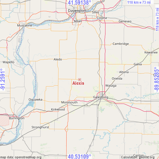
Alexis GPS coordinates[2]
41° 3' 48.132" North, 90° 33' 21.492" West
| Map corner | latitude | longitude |
|---|---|---|
| Upper-left | 41.59138°, | -91.2591° |
| Center: | 41.06337°, | -90.55597° |
| Lower-right: | 40.53109°, | -89.85285° |
| Map W x H: | 117.9×117.9 km | = 73.3×73.3mi |
| max Lat: | 71.29058° ⇑33.4% North |
| Alexis: | 41.06337° |
| min Lat: | ⇓66.6% South 19.06759° |
| min Long | Alexis | max Long |
| -171.73463° | -90.55597° | -66.98998° |
| W 39%⇐ | ⇒61% E |
Elevation
Elevation of Alexis is 215 m = 705 ft, and this is 79.8 m = 262 ft below average elevation for this country.
| Max E: |
3189 m = 10463 ft | 45.8% |
| Avg. | 294.8 m = 967 ft | |
| Alexis | 215 m = 705 ft | |
Min E: |
-60 m = -197 ft | 54.2% |
See also: United States elevation on elevation.city.
Geographical zone
Alexis is located in North temperate zone (between Tropic of Cancer and the Arctic Circle). Distance of this Northern Tropic circle is 1959.9 km =1217.8 mi to South.| Distance of | km | miles | from Alexis |
|---|---|---|---|
| North Pole | 5441.2 | 3381 | to North |
| Arctic Circle | 2835.4 | 1761.8 | to North |
| Tropic Cancer | 1959.9 | 1217.8 | to South |
| Equator | 4565.8 | 2837.1 | to South |


Nearby cities:
15 places around Alexis: (largest is in red/bold)
• Aledo
22.2 km =13.8 mi,  313°
313°
• Alpha
20.5 km =12.7 mi,  45°
45°
• East Galesburg
24.3 km =15.1 mi,  121°
121°
• Galesburg
20.1 km =12.5 mi,  129°
129°
• Kirkwood
27.3 km =17 mi,  216°
216°
• Knoxville
28.5 km =17.7 mi, 127°
• Matherville
22.3 km =13.9 mi,  348°
348°
• Monmouth
18.6 km =11.6 mi,  204°
204°
• New Windsor
18.1 km =11.2 mi,  31°
31°
• Oneida
27.7 km =17.2 mi,  87°
87°
• Reynolds
31.1 km =19.3 mi,  342°
342°
• Sherrard
28.7 km =17.8 mi,  8°
8°
• Viola
15.8 km =9.8 mi, 350°
• Wataga
23.5 km =14.6 mi,  100°
100°
• Woodhull
23.9 km =14.9 mi,  57°
57°
Sources, notices
• [Note1] Compared only with cities in United States existing in our database
• [Src1] Map data: © OpenStreetMap contributors (CC-BY-SA)
• [Src2] Other city data from geonames.org with taken over terms of usage.
• [Src3] Geographical zone / Annual Mean Temperature by Robert A. Rohde @ Wikipedia
