Galesburg geodata
Galesburg (Illinois) is a seat of a second-order administrative division; located in United States in America/Chicago (GMT-5) time zone. With population of 31,273 people, there are 1587 cities with bigger population in this country. Compared to other cities in United States, 65.3% of cities are located further ↓South; 60.4% of cities are located further →East and 59.4% of cities have lower elevation than Galesburg. Note1
Administrative division(s):
- Level 1: Illinois
- Level 2: Knox County
- Level 3: Township of Galesburg City


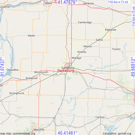
Galesburg GPS coordinates[2]
40° 56' 52.152" North, 90° 22' 16.464" West
| Map corner | latitude | longitude |
|---|---|---|
| Upper-left | 41.47676°, | -91.07437° |
| Center: | 40.94782°, | -90.37124° |
| Lower-right: | 40.41461°, | -89.66812° |
| Map W x H: | 118.1×118.1 km | = 73.4×73.4mi |
| max Lat: | 71.29058° ⇑34.7% North |
| Galesburg: | 40.94782° |
| min Lat: | ⇓65.3% South 19.06759° |
| min Long | Galesburg | max Long |
| -171.73463° | -90.37124° | -66.98998° |
| W 39.6%⇐ | ⇒60.4% E |
Elevation
Elevation of Galesburg is 237 m = 778 ft, and this is 57.8 m = 190 ft below average elevation for this country.
| Max E: |
3189 m = 10463 ft | 40.6% |
| Avg. | 294.8 m = 967 ft | |
| Galesburg | 237 m = 778 ft | |
Min E: |
-60 m = -197 ft | 59.4% |
See also: United States elevation on elevation.city.
Geographical zone
Galesburg is located in North temperate zone (between Tropic of Cancer and the Arctic Circle). Distance of this Northern Tropic circle is 1947.1 km =1209.9 mi to South.| Distance of | km | miles | from Galesburg |
|---|---|---|---|
| North Pole | 5454.1 | 3389 | to North |
| Arctic Circle | 2848.2 | 1769.8 | to North |
| Tropic Cancer | 1947.1 | 1209.9 | to South |
| Equator | 4553 | 2829.1 | to South |


Nearby cities:
15 places around Galesburg: (largest is in red/bold)
• Abingdon
16.1 km =10 mi,  189°
189°
• Alexis
20.1 km =12.5 mi,  309°
309°
• Alpha
27.1 km =16.8 mi,  358°
358°
• Altona
25.4 km =15.8 mi,  43°
43°
• Avon
32 km =19.9 mi, 189°
• East Galesburg
5.1 km =3.2 mi,  90°
90°
• Kirkwood
33 km =20.5 mi,  253°
253°
• Knoxville
8.5 km =5.3 mi,  121°
121°
• Monmouth
23.5 km =14.6 mi,  260°
260°
• New Windsor
28.9 km =18 mi,  348°
348°
• Oak Run
19.1 km =11.9 mi,  84°
84°
• Oneida
18.5 km =11.5 mi, 41°
• Wataga
11.5 km =7.1 mi, 41°
• Williamsfield
30.1 km =18.7 mi,  95°
95°
• Woodhull
26.1 km =16.2 mi,  10°
10°
Sources, notices
• [Note1] Compared only with cities in United States existing in our database
• [Src1] Map data: © OpenStreetMap contributors (CC-BY-SA)
• [Src2] Other city data from geonames.org with taken over terms of usage.
• [Src3] Geographical zone / Annual Mean Temperature by Robert A. Rohde @ Wikipedia
