Chenoa geodata
Chenoa (Illinois) is a populated place; located in United States in America/Chicago (GMT-5) time zone. With population of 1,763 people, there are 12688 cities with bigger population in this country. Compared to other cities in United States, 62.2% of cities are located further ↓South; 55.4% of cities are located further →East and 55.8% of cities have lower elevation than Chenoa. Note1


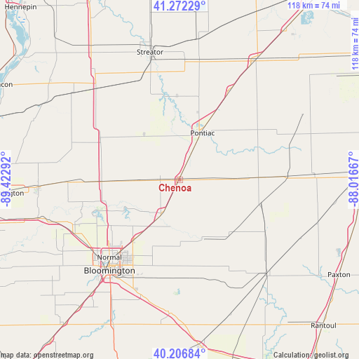
Chenoa GPS coordinates[2]
40° 44' 30.12" North, 88° 43' 11.244" West
| Map corner | latitude | longitude |
|---|---|---|
| Upper-left | 41.27229°, | -89.42292° |
| Center: | 40.7417°, | -88.71979° |
| Lower-right: | 40.20684°, | -88.01667° |
| Map W x H: | 118.5×118.5 km | = 73.6×73.6mi |
| max Lat: | 71.29058° ⇑37.8% North |
| Chenoa: | 40.7417° |
| min Lat: | ⇓62.2% South 19.06759° |
| min Long | Chenoa | max Long |
| -171.73463° | -88.71979° | -66.98998° |
| W 44.6%⇐ | ⇒55.4% E |
Elevation
Elevation of Chenoa is 222 m = 728 ft, and this is 72.8 m = 239 ft below average elevation for this country.
| Max E: |
3189 m = 10463 ft | 44.2% |
| Avg. | 294.8 m = 967 ft | |
| Chenoa | 222 m = 728 ft | |
Min E: |
-60 m = -197 ft | 55.8% |
See also: United States elevation on elevation.city.
Geographical zone
Chenoa is located in North temperate zone (between Tropic of Cancer and the Arctic Circle). Distance of this Northern Tropic circle is 1924.1 km =1195.6 mi to South.| Distance of | km | miles | from Chenoa |
|---|---|---|---|
| North Pole | 5477 | 3403.2 | to North |
| Arctic Circle | 2871.1 | 1784 | to North |
| Tropic Cancer | 1924.1 | 1195.6 | to South |
| Equator | 4530.1 | 2814.9 | to South |


Nearby cities:
15 places around Chenoa: (largest is in red/bold)
• Bloomington
36.8 km =22.9 mi,  218°
218°
• Chatsworth
36.1 km =22.4 mi,  87°
87°
• Colfax
21.3 km =13.2 mi,  155°
155°
• El Paso
25 km =15.5 mi,  269°
269°
• Fairbury
17.3 km =10.7 mi, 87°
• Flanagan
19.3 km =12 mi,  321°
321°
• Forrest
26 km =16.2 mi, 87°
• Gridley
13.6 km =8.5 mi, 270°
• Hudson
27.1 km =16.8 mi,  236°
236°
• Lexington
12.4 km =7.7 mi,  205°
205°
• Minonk
32.1 km =19.9 mi,  304°
304°
• Normal
34.1 km =21.2 mi, 222°
• Odell
33.4 km =20.8 mi,  29°
29°
• Pleasant Hill
14.5 km =9 mi,  189°
189°
• Pontiac
17.2 km =10.7 mi, 26°
Sources, notices
• [Note1] Compared only with cities in United States existing in our database
• [Src1] Map data: © OpenStreetMap contributors (CC-BY-SA)
• [Src2] Other city data from geonames.org with taken over terms of usage.
• [Src3] Geographical zone / Annual Mean Temperature by Robert A. Rohde @ Wikipedia
