Edgewood geodata
Edgewood (Indiana) is a populated place; located in United States in America/Indiana/Indianapolis (GMT-4) time zone. With population of 1,878 people, there are 12283 cities with bigger population in this country. Compared to other cities in United States, 54.6% of cities are located further ↓South; 53.7% of cities are located further ←West and 66.3% of cities have lower elevation than Edgewood. Note1


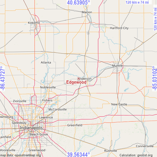
Edgewood GPS coordinates[2]
40° 6' 12.132" North, 85° 44' 2.904" West
| Map corner | latitude | longitude |
|---|---|---|
| Upper-left | 40.63905°, | -86.43727° |
| Center: | 40.10337°, | -85.73414° |
| Lower-right: | 39.56344°, | -85.03102° |
| Map W x H: | 119.6×119.6 km | = 74.3×74.3mi |
| max Lat: | 71.29058° ⇑45.4% North |
| Edgewood: | 40.10337° |
| min Lat: | ⇓54.6% South 19.06759° |
| min Long | Edgewood | max Long |
| -171.73463° | -85.73414° | -66.98998° |
| W 53.7%⇐ | ⇒46.3% E |
Elevation
Elevation of Edgewood is 268 m = 879 ft, and this is 26.8 m = 88 ft below average elevation for this country.
| Max E: |
3189 m = 10463 ft | 33.7% |
| Avg. | 294.8 m = 967 ft | |
| Edgewood | 268 m = 879 ft | |
Min E: |
-60 m = -197 ft | 66.3% |
See also: United States elevation on elevation.city.
Geographical zone
Edgewood is located in North temperate zone (between Tropic of Cancer and the Arctic Circle). Distance of this Northern Tropic circle is 1853.2 km =1151.5 mi to South.| Distance of | km | miles | from Edgewood |
|---|---|---|---|
| North Pole | 5548 | 3447.4 | to North |
| Arctic Circle | 2942.1 | 1828.1 | to North |
| Tropic Cancer | 1853.2 | 1151.5 | to South |
| Equator | 4459.1 | 2770.8 | to South |


Nearby cities:
15 places around Edgewood: (largest is in red/bold)
• Alexandria
18.4 km =11.4 mi,  15°
15°
• Anderson
4.6 km =2.9 mi,  87°
87°
• Chesterfield
11.7 km =7.3 mi, 85°
• Cicero
23.8 km =14.8 mi,  275°
275°
• Daleville
15.1 km =9.4 mi,  82°
82°
• Elwood
21.4 km =13.3 mi,  334°
334°
• Fortville
21.4 km =13.3 mi,  207°
207°
• Frankton
13.8 km =8.6 mi,  344°
344°
• Ingalls
17.4 km =10.8 mi,  200°
200°
• Lapel
10.5 km =6.5 mi,  248°
248°
• Markleville
17.3 km =10.7 mi,  143°
143°
• Middletown
17.5 km =10.9 mi,  107°
107°
• Noblesville
24.2 km =15 mi, 254°
• Pendleton
11.8 km =7.3 mi,  185°
185°
• Yorktown
21.8 km =13.5 mi,  69°
69°
Sources, notices
• [Note1] Compared only with cities in United States existing in our database
• [Src1] Map data: © OpenStreetMap contributors (CC-BY-SA)
• [Src2] Other city data from geonames.org with taken over terms of usage.
• [Src3] Geographical zone / Annual Mean Temperature by Robert A. Rohde @ Wikipedia
