Monticello geodata
Monticello (Indiana) is a seat of a second-order administrative division; located in United States in America/Indiana/Indianapolis (GMT-4) time zone. With population of 5,322 people, there are 6893 cities with bigger population in this country. Compared to other cities in United States, 62.3% of cities are located further ↓South; 50.9% of cities are located further ←West and 51.9% of cities have lower elevation than Monticello. Note1


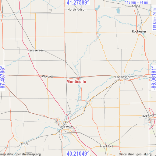
Monticello GPS coordinates[2]
40° 44' 43.152" North, 86° 45' 53.028" West
| Map corner | latitude | longitude |
|---|---|---|
| Upper-left | 41.27589°, | -87.46786° |
| Center: | 40.74532°, | -86.76473° |
| Lower-right: | 40.21049°, | -86.06161° |
| Map W x H: | 118.5×118.5 km | = 73.6×73.6mi |
| max Lat: | 71.29058° ⇑37.7% North |
| Monticello: | 40.74532° |
| min Lat: | ⇓62.3% South 19.06759° |
| min Long | Monticello | max Long |
| -171.73463° | -86.76473° | -66.98998° |
| W 50.9%⇐ | ⇒49.1% E |
Elevation
Elevation of Monticello is 206 m = 676 ft, and this is 88.8 m = 291 ft below average elevation for this country.
| Max E: |
3189 m = 10463 ft | 48.1% |
| Avg. | 294.8 m = 967 ft | |
| Monticello | 206 m = 676 ft | |
Min E: |
-60 m = -197 ft | 51.9% |
See also: United States elevation on elevation.city.
Geographical zone
Monticello is located in North temperate zone (between Tropic of Cancer and the Arctic Circle). Distance of this Northern Tropic circle is 1924.5 km =1195.8 mi to South.| Distance of | km | miles | from Monticello |
|---|---|---|---|
| North Pole | 5476.6 | 3403 | to North |
| Arctic Circle | 2870.7 | 1783.8 | to North |
| Tropic Cancer | 1924.5 | 1195.8 | to South |
| Equator | 4530.5 | 2815.1 | to South |


Nearby cities:
15 places around Monticello: (largest is in red/bold)
• Battle Ground
27.1 km =16.8 mi,  193°
193°
• Brookston
18 km =11.2 mi,  208°
208°
• Buffalo
15.3 km =9.5 mi,  6°
6°
• Camden
24.3 km =15.1 mi,  128°
128°
• Chalmers
12.7 km =7.9 mi,  223°
223°
• Delphi
19.1 km =11.9 mi,  156°
156°
• Dunkirk
31.3 km =19.4 mi,  87°
87°
• Flora
29.9 km =18.6 mi,  137°
137°
• Francesville
28.4 km =17.6 mi,  340°
340°
• Georgetown
21.9 km =13.6 mi, 91°
• Monon
16.7 km =10.4 mi,  324°
324°
• Remington
32.6 km =20.3 mi,  273°
273°
• Reynolds
9 km =5.6 mi, 272°
• Royal Center
25.9 km =16.1 mi,  59°
59°
• Wolcott
23.4 km =14.5 mi, 273°
Sources, notices
• [Note1] Compared only with cities in United States existing in our database
• [Src1] Map data: © OpenStreetMap contributors (CC-BY-SA)
• [Src2] Other city data from geonames.org with taken over terms of usage.
• [Src3] Geographical zone / Annual Mean Temperature by Robert A. Rohde @ Wikipedia
