New York Mills geodata
New York Mills (Minnesota) is a populated place; located in United States in America/Chicago (GMT-5) time zone. With population of 1,225 people, there are 14978 cities with bigger population in this country. Compared to other cities in United States, 95.9% of cities are located further ↓South; 72% of cities are located further →East and 85.4% of cities have lower elevation than New York Mills. Note1
Administrative division(s):
- Level 1: Minnesota
- Level 2: Otter Tail County
- Level 3: City of New York Mills


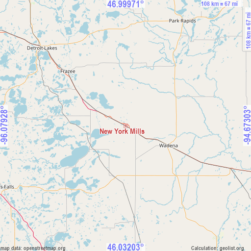
New York Mills GPS coordinates[2]
46° 31' 4.872" North, 95° 22' 34.14" West
| Map corner | latitude | longitude |
|---|---|---|
| Upper-left | 46.99971°, | -96.07928° |
| Center: | 46.51802°, | -95.37615° |
| Lower-right: | 46.03203°, | -94.67303° |
| Map W x H: | 107.6×107.6 km | = 66.9×66.9mi |
| max Lat: | 71.29058° ⇑4.1% North |
| New York Mills: | 46.51802° |
| min Lat: | ⇓95.9% South 19.06759° |
| min Long | New York Mills | max Long |
| -171.73463° | -95.37615° | -66.98998° |
| W 28%⇐ | ⇒72% E |
Elevation
Elevation of New York Mills is 431 m = 1414 ft, and this is 136.2 m = 447 ft above average elevation for this country.
| Max E: |
3189 m = 10463 ft | 14.6% |
| New York Mills | 431 m 1414 ft | |
| Avg. | 294.8 m = 967 ft | |
Min E: |
-60 m = -197 ft | 85.4% |
See also: United States elevation on elevation.city.
Geographical zone
New York Mills is located in North temperate zone (between Tropic of Cancer and the Arctic Circle). Distance of this North polar circle is 2228.9 km =1385 mi to North.| Distance of | km | miles | from New York Mills |
|---|---|---|---|
| North Pole | 4834.7 | 3004.1 | to North |
| Arctic Circle | 2228.9 | 1385 | to North |
| Tropic Cancer | 2566.4 | 1594.7 | to South |
| Equator | 5172.3 | 3213.9 | to South |


Nearby cities:
15 places around New York Mills: (largest is in red/bold)
• Battle Lake
37 km =23 mi,  224°
224°
• Clarissa
54.2 km =33.7 mi,  142°
142°
• Detroit Lakes
48.9 km =30.4 mi,  312°
312°
• Eagle Bend
47 km =29.2 mi,  146°
146°
• Frazee
34.1 km =21.2 mi, 313°
• Henning
22.5 km =14 mi,  193°
193°
• Menahga
33.7 km =20.9 mi,  38°
38°
• Ottertail
17.3 km =10.7 mi,  233°
233°
• Park Rapids
51 km =31.7 mi,  28°
28°
• Parkers Prairie
40.7 km =25.3 mi,  174°
174°
• Perham
17.3 km =10.7 mi,  299°
299°
• Sebeka
25.2 km =15.7 mi,  60°
60°
• Staples
48.3 km =30 mi,  111°
111°
• Verndale
30.7 km =19.1 mi,  115°
115°
• Wadena
20.2 km =12.6 mi, 114°
Sources, notices
• [Note1] Compared only with cities in United States existing in our database
• [Src1] Map data: © OpenStreetMap contributors (CC-BY-SA)
• [Src2] Other city data from geonames.org with taken over terms of usage.
• [Src3] Geographical zone / Annual Mean Temperature by Robert A. Rohde @ Wikipedia
