Hillsboro geodata
Hillsboro (North Dakota) is a seat of a second-order administrative division; located in United States in America/Chicago (GMT-5) time zone. With population of 1,580 people, there are 13353 cities with bigger population in this country. Compared to other cities in United States, 97.4% of cities are located further ↓South; 75.9% of cities are located further →East and 68.2% of cities have lower elevation than Hillsboro. Note1


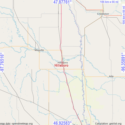
Hillsboro GPS coordinates[2]
47° 24' 13.932" North, 97° 3' 43.308" West
| Map corner | latitude | longitude |
|---|---|---|
| Upper-left | 47.87761°, | -97.76516° |
| Center: | 47.40387°, | -97.06203° |
| Lower-right: | 46.92583°, | -96.35891° |
| Map W x H: | 105.8×105.8 km | = 65.7×65.7mi |
| max Lat: | 71.29058° ⇑2.6% North |
| Hillsboro: | 47.40387° |
| min Lat: | ⇓97.4% South 19.06759° |
| min Long | Hillsboro | max Long |
| -171.73463° | -97.06203° | -66.98998° |
| W 24.1%⇐ | ⇒75.9% E |
Elevation
Elevation of Hillsboro is 277 m = 909 ft, and this is 17.8 m = 58 ft below average elevation for this country.
| Max E: |
3189 m = 10463 ft | 31.8% |
| Avg. | 294.8 m = 967 ft | |
| Hillsboro | 277 m = 909 ft | |
Min E: |
-60 m = -197 ft | 68.2% |
See also: United States elevation on elevation.city.
Geographical zone
Hillsboro is located in North temperate zone (between Tropic of Cancer and the Arctic Circle). Distance of this North polar circle is 2130.4 km =1323.8 mi to North.| Distance of | km | miles | from Hillsboro |
|---|---|---|---|
| North Pole | 4736.2 | 2942.9 | to North |
| Arctic Circle | 2130.4 | 1323.8 | to North |
| Tropic Cancer | 2664.9 | 1655.9 | to South |
| Equator | 5270.8 | 3275.1 | to South |


Nearby cities:
15 places around Hillsboro: (largest is in red/bold)
• Ada
42.8 km =26.6 mi,  105°
105°
• Casselton
57.1 km =35.5 mi,  191°
191°
• Crookston
53.4 km =33.2 mi,  39°
39°
• East Grand Forks
58.6 km =36.4 mi,  2°
2°
• Grand Forks
58 km =36 mi, 2°
• Halstad
18.5 km =11.5 mi, 108°
• Harwood
49.1 km =30.5 mi,  163°
163°
• Hatton
39.4 km =24.5 mi,  311°
311°
• Mapleton
57.2 km =35.5 mi,  179°
179°
• Mayville
22.3 km =13.9 mi,  297°
297°
• Northwood
52.7 km =32.7 mi, 314°
• Oakport
56.7 km =35.2 mi, 157°
• Portland
25.5 km =15.8 mi,  294°
294°
• Reiles Acres
55.5 km =34.5 mi, 164°
• Thompson
41.3 km =25.7 mi,  355°
355°
Sources, notices
• [Note1] Compared only with cities in United States existing in our database
• [Src1] Map data: © OpenStreetMap contributors (CC-BY-SA)
• [Src2] Other city data from geonames.org with taken over terms of usage.
• [Src3] Geographical zone / Annual Mean Temperature by Robert A. Rohde @ Wikipedia
