Grand Forks geodata
Grand Forks (North Dakota) is a seat of a second-order administrative division; located in United States in America/Chicago (GMT-5) time zone. With population of 57,011 people, there are 799 cities with bigger population in this country. Compared to other cities in United States, 98.5% of cities are located further ↓South; 75.8% of cities are located further →East and 63.7% of cities have lower elevation than Grand Forks. Note1
Administrative division(s):
- Level 1: North Dakota
- Level 2: Grand Forks County
- Level 3: City of Grand Forks


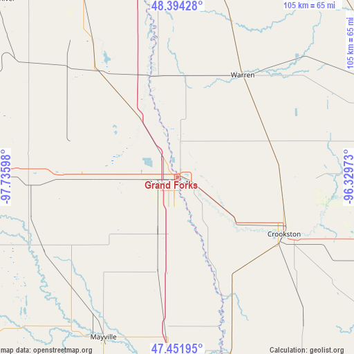
Grand Forks GPS coordinates[2]
47° 55' 30.936" North, 97° 1' 58.26" West
| Map corner | latitude | longitude |
|---|---|---|
| Upper-left | 48.39428°, | -97.73598° |
| Center: | 47.92526°, | -97.03285° |
| Lower-right: | 47.45195°, | -96.32973° |
| Map W x H: | 104.8×104.8 km | = 65.1×65.1mi |
| max Lat: | 71.29058° ⇑1.5% North |
| Grand Forks: | 47.92526° |
| min Lat: | ⇓98.5% South 19.06759° |
| min Long | Grand Forks | max Long |
| -171.73463° | -97.03285° | -66.98998° |
| W 24.2%⇐ | ⇒75.8% E |
Elevation
Elevation of Grand Forks is 256 m = 840 ft, and this is 38.8 m = 127 ft below average elevation for this country.
| Max E: |
3189 m = 10463 ft | 36.3% |
| Avg. | 294.8 m = 967 ft | |
| Grand Forks | 256 m = 840 ft | |
Min E: |
-60 m = -197 ft | 63.7% |
See also: Grand Forks elevation on elevation.city.
Geographical zone
Grand Forks is located in North temperate zone (between Tropic of Cancer and the Arctic Circle). Distance of this North polar circle is 2072.4 km =1287.7 mi to North.| Distance of | km | miles | from Grand Forks |
|---|---|---|---|
| North Pole | 4678.3 | 2907 | to North |
| Arctic Circle | 2072.4 | 1287.7 | to North |
| Tropic Cancer | 2722.9 | 1691.9 | to South |
| Equator | 5328.8 | 3311.2 | to South |


Nearby cities:
15 places around Grand Forks: (largest is in red/bold)
• Argyle
48 km =29.8 mi,  19°
19°
• Crookston
35.9 km =22.3 mi,  117°
117°
• East Grand Forks
0.8 km =0.5 mi,  49°
49°
• Grand Forks Air Force Base
26.6 km =16.5 mi,  277°
277°
• Hatton
44.7 km =27.8 mi,  224°
224°
• Hillsboro
58 km =36 mi,  182°
182°
• Larimore
44.3 km =27.5 mi,  267°
267°
• Mayville
52.3 km =32.5 mi,  204°
204°
• Minto
47.9 km =29.8 mi,  328°
328°
• Northwood
45.2 km =28.1 mi,  241°
241°
• Portland
53.8 km =33.4 mi,  208°
208°
• Red Lake Falls
56.8 km =35.3 mi,  94°
94°
• Stephen
59.5 km =37 mi,  11°
11°
• Thompson
17.8 km =11.1 mi, 198°
• Warren
35.8 km =22.2 mi,  32°
32°
Sources, notices
• [Note1] Compared only with cities in United States existing in our database
• [Src1] Map data: © OpenStreetMap contributors (CC-BY-SA)
• [Src2] Other city data from geonames.org with taken over terms of usage.
• [Src3] Geographical zone / Annual Mean Temperature by Robert A. Rohde @ Wikipedia
