Mullen geodata
Mullen (Nebraska) is a seat of a second-order administrative division; located in United States in America/Denver (GMT-6) time zone. With population of 499 people, there are 20902 cities with bigger population in this country. Compared to other cities in United States, 76% of cities are located further ↓South; 81.4% of cities are located further →East and 93.3% of cities have lower elevation than Mullen. Note1


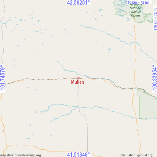
Mullen GPS coordinates[2]
42° 2' 34.008" North, 101° 2' 33.576" West
| Map corner | latitude | longitude |
|---|---|---|
| Upper-left | 42.56281°, | -101.74579° |
| Center: | 42.04278°, | -101.04266° |
| Lower-right: | 41.51846°, | -100.33954° |
| Map W x H: | 116.1×116.1 km | = 72.1×72.1mi |
| max Lat: | 71.29058° ⇑24% North |
| Mullen: | 42.04278° |
| min Lat: | ⇓76% South 19.06759° |
| min Long | Mullen | max Long |
| -171.73463° | -101.04266° | -66.98998° |
| W 18.6%⇐ | ⇒81.4% E |
Elevation
Elevation of Mullen is 977 m = 3205 ft, and this is 682.2 m = 2238 ft above average elevation for this country.
| Max E: |
3189 m = 10463 ft | 6.7% |
| Mullen | 977 m 3205 ft | |
| Avg. | 294.8 m = 967 ft | |
Min E: |
-60 m = -197 ft | 93.3% |
See also: United States elevation on elevation.city.
Geographical zone
Mullen is located in North temperate zone (between Tropic of Cancer and the Arctic Circle). Distance of this Northern Tropic circle is 2068.8 km =1285.5 mi to South.| Distance of | km | miles | from Mullen |
|---|---|---|---|
| North Pole | 5332.3 | 3313.3 | to North |
| Arctic Circle | 2726.5 | 1694.2 | to North |
| Tropic Cancer | 2068.8 | 1285.5 | to South |
| Equator | 4674.7 | 2904.7 | to South |


Nearby cities:
15 places around Mullen: (largest is in red/bold)
• Ainsworth
112.2 km =69.7 mi,  59°
59°
• Arnold
98.6 km =61.3 mi,  134°
134°
• Arthur
75.1 km =46.7 mi,  225°
225°
• Brewster
98 km =60.9 mi,  96°
96°
• Callaway
125 km =77.7 mi, 131°
• Hershey
98.4 km =61.1 mi,  178°
178°
• Hyannis
59.6 km =37 mi,  265°
265°
• North Platte
104.7 km =65.1 mi,  167°
167°
• Ogallala
116.3 km =72.3 mi,  208°
208°
• Saint Francis
123 km =76.4 mi,  5°
5°
• Stapleton
76.4 km =47.5 mi,  144°
144°
• Sutherland
98.7 km =61.3 mi, 184°
• Thedford
39.2 km =24.4 mi, 100°
• Tryon
54.9 km =34.1 mi, 172°
• Valentine
100.7 km =62.6 mi,  23°
23°
Sources, notices
• [Note1] Compared only with cities in United States existing in our database
• [Src1] Map data: © OpenStreetMap contributors (CC-BY-SA)
• [Src2] Other city data from geonames.org with taken over terms of usage.
• [Src3] Geographical zone / Annual Mean Temperature by Robert A. Rohde @ Wikipedia
