North East geodata
North East (Pennsylvania) is a populated place; located in United States in America/New_York (GMT-4) time zone. With population of 4,172 people, there are 8025 cities with bigger population in this country. Compared to other cities in United States, 77.5% of cities are located further ↓South; 74.1% of cities are located further ←West and 61% of cities have lower elevation than North East. Note1
Administrative division(s):
- Level 1: Pennsylvania
- Level 2: Erie County
- Level 3: Borough of North East


North East GPS coordinates[2]
42° 12' 56.196" North, 79° 50' 3.192" West
| Map corner | latitude | longitude |
|---|---|---|
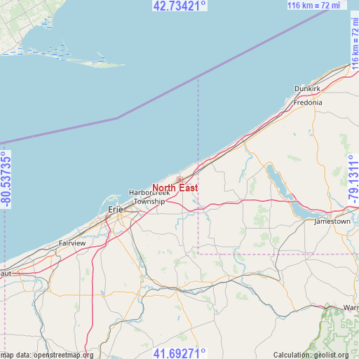
| Upper-left | 42.73421°, | -80.53735° |
| Center: | 42.21561°, | -79.83422° |
| Lower-right: | 41.69271°, | -79.1311° |
| Map W x H: | 115.8×115.8 km | = 72×72mi |
| max Lat: | 71.29058° ⇑22.5% North |
| North East: | 42.21561° |
| min Lat: | ⇓77.5% South 19.06759° |
| min Long | North East | max Long |
| -171.73463° | -79.83422° | -66.98998° |
| W 74.1%⇐ | ⇒25.9% E |
Elevation
Elevation of North East is 244 m = 801 ft, and this is 50.8 m = 167 ft below average elevation for this country.
| Max E: |
3189 m = 10463 ft | 39% |
| Avg. | 294.8 m = 967 ft | |
| North East | 244 m = 801 ft | |
Min E: |
-60 m = -197 ft | 61% |
See also: United States elevation on elevation.city.
Geographical zone
North East is located in North temperate zone (between Tropic of Cancer and the Arctic Circle). Distance of this Northern Tropic circle is 2088 km =1297.4 mi to South.| Distance of | km | miles | from North East |
|---|---|---|---|
| North Pole | 5313.1 | 3301.4 | to North |
| Arctic Circle | 2707.2 | 1682.2 | to North |
| Tropic Cancer | 2088 | 1297.4 | to South |
| Equator | 4693.9 | 2916.7 | to South |


Nearby cities:
15 places around North East: (largest is in red/bold)
• Brocton
37.6 km =23.4 mi,  59°
59°
• Clymer
27.4 km =17 mi,  142°
142°
• Columbus
37 km =23 mi,  145°
145°
• Corry
36.5 km =22.7 mi, 154°
• Erie
22.8 km =14.2 mi,  245°
245°
• Lawrence Park
17.1 km =10.6 mi, 245°
• Mayville
27.5 km =17.1 mi,  81°
81°
• Northwest Harborcreek
15.1 km =9.4 mi,  240°
240°
• Portland
35.3 km =21.9 mi, 58°
• Ripley
11.7 km =7.3 mi, 60°
• Sherman
20.7 km =12.9 mi,  107°
107°
• Union City
35.2 km =21.9 mi,  181°
181°
• Waterford
32.8 km =20.4 mi,  202°
202°
• Wesleyville
17.1 km =10.6 mi, 240°
• Westfield
24.2 km =15 mi, 60°
Sources, notices
• [Note1] Compared only with cities in United States existing in our database
• [Src1] Map data: © OpenStreetMap contributors (CC-BY-SA)
• [Src2] Other city data from geonames.org with taken over terms of usage.
• [Src3] Geographical zone / Annual Mean Temperature by Robert A. Rohde @ Wikipedia
