Faulkton geodata
Faulkton (South Dakota) is a seat of a second-order administrative division; located in United States in America/Chicago (GMT-5) time zone. With population of 740 people, there are 18306 cities with bigger population in this country. Compared to other cities in United States, 92.7% of cities are located further ↓South; 80% of cities are located further →East and 87.4% of cities have lower elevation than Faulkton. Note1


Faulkton GPS coordinates[2]
45° 2' 5.892" North, 99° 7' 26.4" West
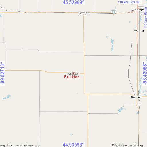
| Map corner | latitude | longitude |
|---|---|---|
| Upper-left | 45.52969°, | -99.82713° |
| Center: | 45.03497°, | -99.124° |
| Lower-right: | 44.53593°, | -98.42088° |
| Map W x H: | 110.5×110.5 km | = 68.7×68.7mi |
| max Lat: | 71.29058° ⇑7.3% North |
| Faulkton: | 45.03497° |
| min Lat: | ⇓92.7% South 19.06759° |
| min Long | Faulkton | max Long |
| -171.73463° | -99.124° | -66.98998° |
| W 20%⇐ | ⇒80% E |
Elevation
Elevation of Faulkton is 482 m = 1581 ft, and this is 187.2 m = 614 ft above average elevation for this country.
| Max E: |
3189 m = 10463 ft | 12.6% |
| Faulkton | 482 m 1581 ft | |
| Avg. | 294.8 m = 967 ft | |
Min E: |
-60 m = -197 ft | 87.4% |
See also: United States elevation on elevation.city.
Geographical zone
Faulkton is located in North temperate zone (between Tropic of Cancer and the Arctic Circle). Distance of this North polar circle is 2393.8 km =1487.4 mi to North.| Distance of | km | miles | from Faulkton |
|---|---|---|---|
| North Pole | 4999.6 | 3106.6 | to North |
| Arctic Circle | 2393.8 | 1487.4 | to North |
| Tropic Cancer | 2401.5 | 1492.2 | to South |
| Equator | 5007.4 | 3111.5 | to South |


Nearby cities:
15 places around Faulkton: (largest is in red/bold)
• Aberdeen
69.1 km =42.9 mi,  46°
46°
• Bowdle
62.3 km =38.7 mi,  318°
318°
• Eureka
90.4 km =56.2 mi,  334°
334°
• Fort Thompson
110.3 km =68.5 mi,  193°
193°
• Gettysburg
65.4 km =40.6 mi,  267°
267°
• Groton
92.4 km =57.4 mi,  60°
60°
• Highmore
62.4 km =38.8 mi,  203°
203°
• Huron
103.7 km =64.4 mi,  136°
136°
• Ipswich
46.1 km =28.6 mi,  9°
9°
• Leola
77.8 km =48.3 mi, 10°
• Miller
58.4 km =36.3 mi,  169°
169°
• Mound City
106.4 km =66.1 mi, 316°
• Onida
82.2 km =51.1 mi,  243°
243°
• Redfield
50.8 km =31.6 mi,  110°
110°
• Selby
88.3 km =54.9 mi,  306°
306°
Sources, notices
• [Note1] Compared only with cities in United States existing in our database
• [Src1] Map data: © OpenStreetMap contributors (CC-BY-SA)
• [Src2] Other city data from geonames.org with taken over terms of usage.
• [Src3] Geographical zone / Annual Mean Temperature by Robert A. Rohde @ Wikipedia
