Hotevilla-Bacavi geodata
Hotevilla-Bacavi (Arizona) is a populated place; located in United States in America/Phoenix (GMT-7) time zone. With population of 957 people, there are 16591 cities with bigger population in this country. Compared to other cities in United States, 70.7% of cities are located further ↑North; 86% of cities are located further →East and 98.9% of cities have lower elevation than Hotevilla-Bacavi. Note1


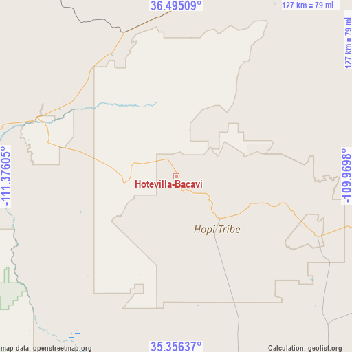
Hotevilla-Bacavi GPS coordinates[2]
35° 55' 40.008" North, 110° 40' 22.512" West
| Map corner | latitude | longitude |
|---|---|---|
| Upper-left | 36.49509°, | -111.37605° |
| Center: | 35.92778°, | -110.67292° |
| Lower-right: | 35.35637°, | -109.9698° |
| Map W x H: | 126.6×126.6 km | = 78.7×78.7mi |
| max Lat: | 71.29058° ⇑70.7% North |
| Hotevilla-Bacavi: | 35.92778° |
| min Lat: | ⇓29.3% South 19.06759° |
| min Long | Hotevilla-Bacav | max Long |
| -171.73463° | -110.67292° | -66.98998° |
| W 14%⇐ | ⇒86% E |
Elevation
Elevation of Hotevilla-Bacavi is 1930 m = 6332 ft, and this is 1635.2 m = 5365 ft above average elevation for this country.
| Max E: |
3189 m = 10463 ft | 1.1% |
| Hotevilla-Bacavi | 1930 m 6332 ft | |
| Avg. | 294.8 m = 967 ft | |
Min E: |
-60 m = -197 ft | 98.9% |
See also: United States elevation on elevation.city.
Geographical zone
Hotevilla-Bacavi is located in North temperate zone (between Tropic of Cancer and the Arctic Circle). Distance of this Northern Tropic circle is 1388.9 km =863 mi to South.| Distance of | km | miles | from Hotevilla-Bacavi |
|---|---|---|---|
| North Pole | 6012.3 | 3735.9 | to North |
| Arctic Circle | 3406.4 | 2116.6 | to North |
| Tropic Cancer | 1388.9 | 863 | to South |
| Equator | 3994.8 | 2482.3 | to South |


Nearby cities:
15 places around Hotevilla-Bacavi: (largest is in red/bold)
• Cameron
66.9 km =41.6 mi,  265°
265°
• Dilkon
68.2 km =42.4 mi,  152°
152°
• First Mesa
28.1 km =17.5 mi,  111°
111°
• Kykotsmovi Village
7.4 km =4.6 mi,  143°
143°
• Leupp
76.2 km =47.3 mi,  203°
203°
• Low Mountain
50.4 km =31.3 mi,  88°
88°
• Moenkopi
53.5 km =33.2 mi,  292°
292°
• Pinon
44.6 km =27.7 mi,  64°
64°
• Second Mesa
21.3 km =13.2 mi,  134°
134°
• Shongopovi
17.4 km =10.8 mi, 134°
• Shonto
74.2 km =46.1 mi,  2°
2°
• Shungopavi
18.9 km =11.7 mi, 136°
• Tonalea
51.1 km =31.8 mi,  329°
329°
• Tuba City
55.9 km =34.7 mi, 294°
• White Cone
65.3 km =40.6 mi,  123°
123°
Sources, notices
• [Note1] Compared only with cities in United States existing in our database
• [Src1] Map data: © OpenStreetMap contributors (CC-BY-SA)
• [Src2] Other city data from geonames.org with taken over terms of usage.
• [Src3] Geographical zone / Annual Mean Temperature by Robert A. Rohde @ Wikipedia
