Kykotsmovi Village geodata
Kykotsmovi Village (Arizona) is a populated place; located in United States in America/Phoenix (GMT-7) time zone. With population of 746 people, there are 18241 cities with bigger population in this country. Compared to other cities in United States, 71% of cities are located further ↑North; 86% of cities are located further →East and 98.1% of cities have lower elevation than Kykotsmovi Village. Note1


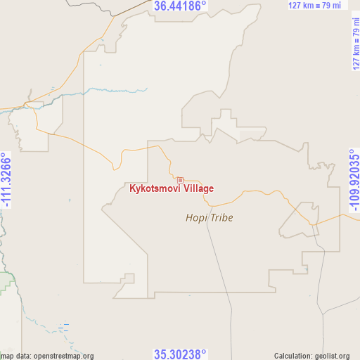
Kykotsmovi Village GPS coordinates[2]
35° 52' 27.012" North, 110° 37' 24.492" West
| Map corner | latitude | longitude |
|---|---|---|
| Upper-left | 36.44186°, | -111.3266° |
| Center: | 35.87417°, | -110.62347° |
| Lower-right: | 35.30238°, | -109.92035° |
| Map W x H: | 126.7×126.7 km | = 78.7×78.7mi |
| max Lat: | 71.29058° ⇑71% North |
| Kykotsmovi Village: | 35.87417° |
| min Lat: | ⇓29% South 19.06759° |
| min Long | Kykotsmovi Vill | max Long |
| -171.73463° | -110.62347° | -66.98998° |
| W 14%⇐ | ⇒86% E |
Elevation
Elevation of Kykotsmovi Village is 1732 m = 5682 ft, and this is 1437.2 m = 4715 ft above average elevation for this country.
| Max E: |
3189 m = 10463 ft | 1.9% |
| Kykotsmovi Village | 1732 m 5682 ft | |
| Avg. | 294.8 m = 967 ft | |
Min E: |
-60 m = -197 ft | 98.1% |
See also: United States elevation on elevation.city.
Geographical zone
Kykotsmovi Village is located in North temperate zone (between Tropic of Cancer and the Arctic Circle). Distance of this Northern Tropic circle is 1382.9 km =859.3 mi to South.| Distance of | km | miles | from Kykotsmovi Village |
|---|---|---|---|
| North Pole | 6018.2 | 3739.5 | to North |
| Arctic Circle | 3412.3 | 2120.3 | to North |
| Tropic Cancer | 1382.9 | 859.3 | to South |
| Equator | 3988.8 | 2478.5 | to South |


Nearby cities:
15 places around Kykotsmovi Village: (largest is in red/bold)
• Cameron
71.1 km =44.2 mi,  270°
270°
• Dilkon
60.9 km =37.8 mi,  153°
153°
• First Mesa
22.2 km =13.8 mi,  100°
100°
• Greasewood
79.5 km =49.4 mi,  119°
119°
• Hotevilla-Bacavi
7.4 km =4.6 mi,  323°
323°
• Leupp
72.8 km =45.2 mi,  208°
208°
• Low Mountain
46.5 km =28.9 mi,  80°
80°
• Moenkopi
60 km =37.3 mi,  296°
296°
• Pinon
43.8 km =27.2 mi,  54°
54°
• Second Mesa
13.9 km =8.6 mi,  130°
130°
• Shongopovi
10.2 km =6.3 mi, 127°
• Shungopavi
11.5 km =7.1 mi, 131°
• Tonalea
58.5 km =36.4 mi,  328°
328°
• Tuba City
62.6 km =38.9 mi, 297°
• White Cone
58.4 km =36.3 mi, 120°
Sources, notices
• [Note1] Compared only with cities in United States existing in our database
• [Src1] Map data: © OpenStreetMap contributors (CC-BY-SA)
• [Src2] Other city data from geonames.org with taken over terms of usage.
• [Src3] Geographical zone / Annual Mean Temperature by Robert A. Rohde @ Wikipedia
