Carmel-by-the-Sea geodata
Carmel-by-the-Sea (California) is a populated place; located in United States in America/Los_Angeles (GMT-7) time zone. With population of 3,897 people, there are 8329 cities with bigger population in this country. Compared to other cities in United States, 67.9% of cities are located further ↑North; 94.9% of cities are located further →East and 76.3% of cities have higher elevation than Carmel-by-the-Sea. Note1


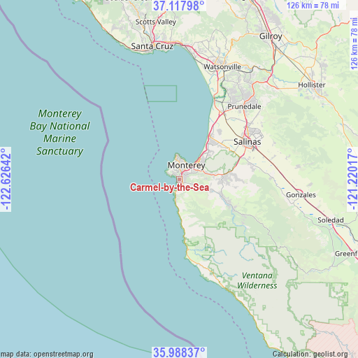
Carmel-by-the-Sea GPS coordinates[2]
36° 33' 18.864" North, 121° 55' 23.844" West
| Map corner | latitude | longitude |
|---|---|---|
| Upper-left | 37.11798°, | -122.62642° |
| Center: | 36.55524°, | -121.92329° |
| Lower-right: | 35.98837°, | -121.22017° |
| Map W x H: | 125.6×125.6 km | = 78×78mi |
| max Lat: | 71.29058° ⇑67.9% North |
| Carmel-by-the-Sea: | 36.55524° |
| min Lat: | ⇓32.1% South 19.06759° |
| min Long | Carmel-by-the-S | max Long |
| -171.73463° | -121.92329° | -66.98998° |
| W 5.1%⇐ | ⇒94.9% E |
Elevation
Elevation of Carmel-by-the-Sea is 64 m = 210 ft, and this is 230.8 m = 757 ft below average elevation for this country.
| Max E: |
3189 m = 10463 ft | 76.3% |
| Avg. | 294.8 m = 967 ft | |
| Carmel-by-the-Sea | 64 m = 210 ft | |
Min E: |
-60 m = -197 ft | 23.7% |
See also: United States elevation on elevation.city.
Geographical zone
Carmel-by-the-Sea is located in North temperate zone (between Tropic of Cancer and the Arctic Circle). Distance of this Northern Tropic circle is 1458.6 km =906.3 mi to South.| Distance of | km | miles | from Carmel-by-the-Sea |
|---|---|---|---|
| North Pole | 5942.5 | 3692.5 | to North |
| Arctic Circle | 3336.6 | 2073.3 | to North |
| Tropic Cancer | 1458.6 | 906.3 | to South |
| Equator | 4064.6 | 2525.6 | to South |


Nearby cities:
15 places around Carmel-by-the-Sea: (largest is in red/bold)
• Big Sur
33.3 km =20.7 mi,  161°
161°
• Boronda
27.3 km =17 mi,  54°
54°
• Carmel Valley Village
15.1 km =9.4 mi,  111°
111°
• Castroville
27.7 km =17.2 mi,  32°
32°
• Chualar
36.2 km =22.5 mi,  87°
87°
• Del Monte Forest
4.1 km =2.5 mi,  328°
328°
• Del Rey Oaks
9 km =5.6 mi,  61°
61°
• Elkhorn
34.1 km =21.2 mi, 28°
• Marina
18 km =11.2 mi,  36°
36°
• Monterey
5.6 km =3.5 mi, 27°
• Pacific Grove
7 km =4.3 mi,  4°
4°
• Prunedale
33.4 km =20.8 mi, 42°
• Salinas
27.5 km =17.1 mi, 60°
• Seaside
8.9 km =5.5 mi, 45°
• Spreckels
25.8 km =16 mi,  73°
73°
Sources, notices
• [Note1] Compared only with cities in United States existing in our database
• [Src1] Map data: © OpenStreetMap contributors (CC-BY-SA)
• [Src2] Other city data from geonames.org with taken over terms of usage.
• [Src3] Geographical zone / Annual Mean Temperature by Robert A. Rohde @ Wikipedia
