Upland geodata
Upland (California) is a populated place; located in United States in America/Los_Angeles (GMT-7) time zone. With population of 76,443 people, there are 524 cities with bigger population in this country. Compared to other cities in United States, 79.6% of cities are located further ↑North; 90.5% of cities are located further →East and 82.3% of cities have lower elevation than Upland. Note1


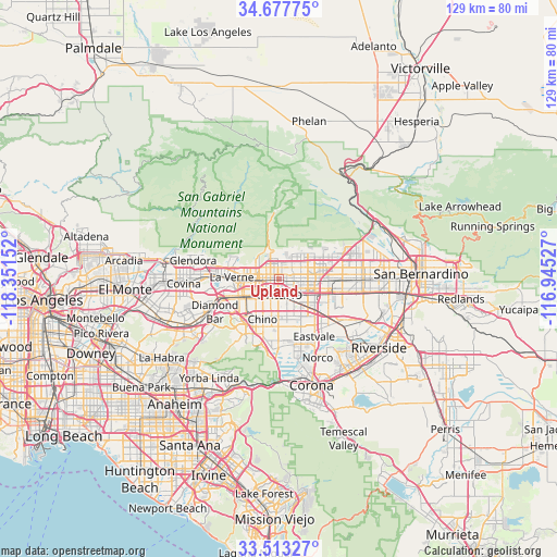
Upland GPS coordinates[2]
34° 5' 51.036" North, 117° 38' 54.204" West
| Map corner | latitude | longitude |
|---|---|---|
| Upper-left | 34.67775°, | -118.35152° |
| Center: | 34.09751°, | -117.64839° |
| Lower-right: | 33.51327°, | -116.94527° |
| Map W x H: | 129.5×129.5 km | = 80.5×80.5mi |
| max Lat: | 71.29058° ⇑79.6% North |
| Upland: | 34.09751° |
| min Lat: | ⇓20.4% South 19.06759° |
| min Long | Upland | max Long |
| -171.73463° | -117.64839° | -66.98998° |
| W 9.5%⇐ | ⇒90.5% E |
Elevation
Elevation of Upland is 380 m = 1247 ft, and this is 85.2 m = 280 ft above average elevation for this country.
| Max E: |
3189 m = 10463 ft | 17.7% |
| Upland | 380 m 1247 ft | |
| Avg. | 294.8 m = 967 ft | |
Min E: |
-60 m = -197 ft | 82.3% |
See also: Upland elevation on elevation.city.
Geographical zone
Upland is located in North temperate zone (between Tropic of Cancer and the Arctic Circle). Distance of this Northern Tropic circle is 1185.4 km =736.6 mi to South.| Distance of | km | miles | from Upland |
|---|---|---|---|
| North Pole | 6215.8 | 3862.3 | to North |
| Arctic Circle | 3609.9 | 2243.1 | to North |
| Tropic Cancer | 1185.4 | 736.6 | to South |
| Equator | 3791.3 | 2355.8 | to South |


Nearby cities:
15 places around Upland: (largest is in red/bold)
• Chino
10.2 km =6.3 mi,  201°
201°
• Chino Hills
15.4 km =9.6 mi,  221°
221°
• Claremont
6.6 km =4.1 mi,  269°
269°
• Diamond Bar
16.8 km =10.4 mi,  242°
242°
• Eastvale
16.8 km =10.4 mi,  152°
152°
• Glen Avon
17.8 km =11.1 mi,  122°
122°
• Jurupa Valley
16.9 km =10.5 mi,  133°
133°
• La Verne
11 km =6.8 mi, 271°
• Los Serranos
14.9 km =9.3 mi, 201°
• Montclair
4.4 km =2.7 mi, 239°
• Ontario
3.8 km =2.4 mi,  183°
183°
• Pomona
10.7 km =6.6 mi, 243°
• Rancho Cucamonga
5.2 km =3.2 mi,  79°
79°
• San Antonio Heights
6.5 km =4 mi,  353°
353°
• San Dimas
14.6 km =9.1 mi, 274°
Sources, notices
• [Note1] Compared only with cities in United States existing in our database
• [Src1] Map data: © OpenStreetMap contributors (CC-BY-SA)
• [Src2] Other city data from geonames.org with taken over terms of usage.
• [Src3] Geographical zone / Annual Mean Temperature by Robert A. Rohde @ Wikipedia
