Garden City geodata
Garden City (Kansas) is a seat of a second-order administrative division; located in United States in America/Chicago (GMT-5) time zone. With population of 27,005 people, there are 1852 cities with bigger population in this country. Compared to other cities in United States, 61.8% of cities are located further ↑North; 81.3% of cities are located further →East and 92.5% of cities have lower elevation than Garden City. Note1


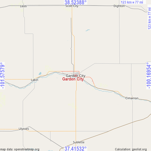
Garden City GPS coordinates[2]
37° 58' 18.084" North, 100° 52' 21.576" West
| Map corner | latitude | longitude |
|---|---|---|
| Upper-left | 38.52388°, | -101.57579° |
| Center: | 37.97169°, | -100.87266° |
| Lower-right: | 37.41532°, | -100.16954° |
| Map W x H: | 123.3×123.3 km | = 76.6×76.6mi |
| max Lat: | 71.29058° ⇑61.8% North |
| Garden City: | 37.97169° |
| min Lat: | ⇓38.2% South 19.06759° |
| min Long | Garden City | max Long |
| -171.73463° | -100.87266° | -66.98998° |
| W 18.7%⇐ | ⇒81.3% E |
Elevation
Elevation of Garden City is 870 m = 2854 ft, and this is 575.2 m = 1887 ft above average elevation for this country.
| Max E: |
3189 m = 10463 ft | 7.5% |
| Garden City | 870 m 2854 ft | |
| Avg. | 294.8 m = 967 ft | |
Min E: |
-60 m = -197 ft | 92.5% |
See also: United States elevation on elevation.city.
Geographical zone
Garden City is located in North temperate zone (between Tropic of Cancer and the Arctic Circle). Distance of this Northern Tropic circle is 1616.1 km =1004.2 mi to South.| Distance of | km | miles | from Garden City |
|---|---|---|---|
| North Pole | 5785 | 3594.6 | to North |
| Arctic Circle | 3179.1 | 1975.4 | to North |
| Tropic Cancer | 1616.1 | 1004.2 | to South |
| Equator | 4222.1 | 2623.5 | to South |


Nearby cities:
15 places around Garden City: (largest is in red/bold)
• Cimarron
49.5 km =30.8 mi,  111°
111°
• Deerfield
22.9 km =14.2 mi,  272°
272°
• Dighton
66.9 km =41.6 mi,  31°
31°
• Dodge City
78.9 km =49 mi, 107°
• Holcomb
10.4 km =6.5 mi,  278°
278°
• Jetmore
86.7 km =53.9 mi,  81°
81°
• Lakin
33.7 km =20.9 mi,  264°
264°
• Leoti
70.7 km =43.9 mi,  323°
323°
• Montezuma
56.3 km =35 mi,  137°
137°
• Plains
82.9 km =51.5 mi,  162°
162°
• Satanta
60.1 km =37.3 mi,  188°
188°
• Scott City
56.9 km =35.4 mi,  356°
356°
• Sublette
54.5 km =33.9 mi,  177°
177°
• Syracuse
77.3 km =48 mi, 270°
• Ulysses
60.7 km =37.7 mi,  224°
224°
Sources, notices
• [Note1] Compared only with cities in United States existing in our database
• [Src1] Map data: © OpenStreetMap contributors (CC-BY-SA)
• [Src2] Other city data from geonames.org with taken over terms of usage.
• [Src3] Geographical zone / Annual Mean Temperature by Robert A. Rohde @ Wikipedia
