Lovington geodata
Lovington (New Mexico) is a seat of a second-order administrative division; located in United States in America/Denver (GMT-6) time zone. With population of 11,800 people, there are 3943 cities with bigger population in this country. Compared to other cities in United States, 85.4% of cities are located further ↑North; 82.4% of cities are located further →East and 94.5% of cities have lower elevation than Lovington. Note1


Lovington GPS coordinates[2]
32° 56' 38.436" North, 103° 20' 54.78" West
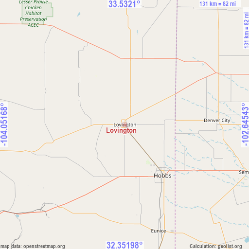
| Map corner | latitude | longitude |
|---|---|---|
| Upper-left | 33.5321°, | -104.05168° |
| Center: | 32.94401°, | -103.34855° |
| Lower-right: | 32.35198°, | -102.64543° |
| Map W x H: | 131.2×131.2 km | = 81.5×81.5mi |
| max Lat: | 71.29058° ⇑85.4% North |
| Lovington: | 32.94401° |
| min Lat: | ⇓14.6% South 19.06759° |
| min Long | Lovington | max Long |
| -171.73463° | -103.34855° | -66.98998° |
| W 17.6%⇐ | ⇒82.4% E |
Elevation
Elevation of Lovington is 1195 m = 3921 ft, and this is 900.2 m = 2953 ft above average elevation for this country.
| Max E: |
3189 m = 10463 ft | 5.5% |
| Lovington | 1195 m 3921 ft | |
| Avg. | 294.8 m = 967 ft | |
Min E: |
-60 m = -197 ft | 94.5% |
See also: United States elevation on elevation.city.
Geographical zone
Lovington is located in North temperate zone (between Tropic of Cancer and the Arctic Circle). Distance of this Northern Tropic circle is 1057.1 km =656.9 mi to South.| Distance of | km | miles | from Lovington |
|---|---|---|---|
| North Pole | 6344 | 3942 | to North |
| Arctic Circle | 3738.1 | 2322.7 | to North |
| Tropic Cancer | 1057.1 | 656.9 | to South |
| Equator | 3663 | 2276.1 | to South |


Nearby cities:
15 places around Lovington: (largest is in red/bold)
• Artesia
99.1 km =61.6 mi,  263°
263°
• Atoka
99.1 km =61.6 mi, 258°
• Denver City
48.5 km =30.1 mi,  87°
87°
• Dexter
99.5 km =61.8 mi,  286°
286°
• Eunice
59.1 km =36.7 mi,  162°
162°
• Hagerman
93.2 km =57.9 mi,  281°
281°
• Hobbs
33.4 km =20.8 mi,  143°
143°
• Jal
93.5 km =58.1 mi,  171°
171°
• La Huerta
98.8 km =61.4 mi,  235°
235°
• Livingston Wheeler
100.9 km =62.7 mi,  232°
232°
• Plains
55.6 km =34.5 mi,  60°
60°
• Seagraves
73.1 km =45.4 mi, 89°
• Seminole
70.3 km =43.7 mi,  110°
110°
• Sundown
98.2 km =61 mi,  54°
54°
• Tatum
34.9 km =21.7 mi,  4°
4°
Sources, notices
• [Note1] Compared only with cities in United States existing in our database
• [Src1] Map data: © OpenStreetMap contributors (CC-BY-SA)
• [Src2] Other city data from geonames.org with taken over terms of usage.
• [Src3] Geographical zone / Annual Mean Temperature by Robert A. Rohde @ Wikipedia
