Miles geodata
Miles (Texas) is a populated place; located in United States in America/Chicago (GMT-5) time zone. With population of 864 people, there are 17246 cities with bigger population in this country. Compared to other cities in United States, 89.4% of cities are located further ↑North; 80.8% of cities are located further →East and 88.8% of cities have lower elevation than Miles. Note1


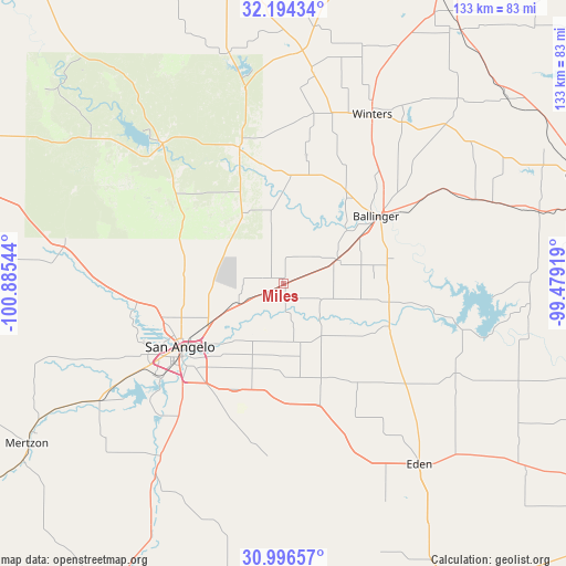
Miles GPS coordinates[2]
31° 35' 50.568" North, 100° 10' 56.316" West
| Map corner | latitude | longitude |
|---|---|---|
| Upper-left | 32.19434°, | -100.88544° |
| Center: | 31.59738°, | -100.18231° |
| Lower-right: | 30.99657°, | -99.47919° |
| Map W x H: | 133.2×133.2 km | = 82.8×82.8mi |
| max Lat: | 71.29058° ⇑89.4% North |
| Miles: | 31.59738° |
| min Lat: | ⇓10.6% South 19.06759° |
| min Long | Miles | max Long |
| -171.73463° | -100.18231° | -66.98998° |
| W 19.2%⇐ | ⇒80.8% E |
Elevation
Elevation of Miles is 550 m = 1804 ft, and this is 255.2 m = 837 ft above average elevation for this country.
| Max E: |
3189 m = 10463 ft | 11.2% |
| Miles | 550 m 1804 ft | |
| Avg. | 294.8 m = 967 ft | |
Min E: |
-60 m = -197 ft | 88.8% |
See also: United States elevation on elevation.city.
Geographical zone
Miles is located in North temperate zone (between Tropic of Cancer and the Arctic Circle). Distance of this Northern Tropic circle is 907.4 km =563.8 mi to South.| Distance of | km | miles | from Miles |
|---|---|---|---|
| North Pole | 6493.8 | 4035.1 | to North |
| Arctic Circle | 3887.9 | 2415.8 | to North |
| Tropic Cancer | 907.4 | 563.8 | to South |
| Equator | 3513.3 | 2183.1 | to South |


Nearby cities:
15 places around Miles: (largest is in red/bold)
• Ballinger
27.2 km =16.9 mi,  54°
54°
• Bronte
33.9 km =21.1 mi,  342°
342°
• Carlsbad
43.7 km =27.2 mi,  271°
271°
• Christoval
54 km =33.6 mi,  213°
213°
• Coleman
75.9 km =47.2 mi,  70°
70°
• Eden
53.1 km =33 mi,  142°
142°
• Grape Creek
34.7 km =21.6 mi, 266°
• Mertzon
70.9 km =44.1 mi,  238°
238°
• Paint Rock
26.7 km =16.6 mi,  111°
111°
• Robert Lee
43.5 km =27 mi,  318°
318°
• San Angelo
28.3 km =17.6 mi, 238°
• Santa Anna
83 km =51.6 mi,  78°
78°
• Sterling City
80.4 km =50 mi,  289°
289°
• Tuscola
77.2 km =48 mi,  28°
28°
• Winters
45 km =28 mi, 27°
Sources, notices
• [Note1] Compared only with cities in United States existing in our database
• [Src1] Map data: © OpenStreetMap contributors (CC-BY-SA)
• [Src2] Other city data from geonames.org with taken over terms of usage.
• [Src3] Geographical zone / Annual Mean Temperature by Robert A. Rohde @ Wikipedia
