Plentywood geodata
Plentywood (Montana) is a seat of a second-order administrative division; located in United States in America/Denver (GMT-6) time zone. With population of 1,923 people, there are 12167 cities with bigger population in this country. Compared to other cities in United States, 99.3% of cities are located further ↓South; 82.8% of cities are located further →East and 90% of cities have lower elevation than Plentywood. Note1


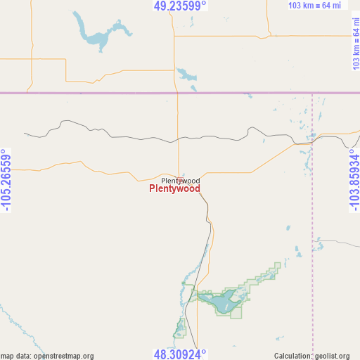
Plentywood GPS coordinates[2]
48° 46' 29.1" North, 104° 33' 44.856" West
| Map corner | latitude | longitude |
|---|---|---|
| Upper-left | 49.23599°, | -105.26559° |
| Center: | 48.77475°, | -104.56246° |
| Lower-right: | 48.30924°, | -103.85934° |
| Map W x H: | 103×103 km | = 64×64mi |
| max Lat: | 71.29058° ⇑0.7% North |
| Plentywood: | 48.77475° |
| min Lat: | ⇓99.3% South 19.06759° |
| min Long | Plentywood | max Long |
| -171.73463° | -104.56246° | -66.98998° |
| W 17.2%⇐ | ⇒82.8% E |
Elevation
Elevation of Plentywood is 623 m = 2044 ft, and this is 328.2 m = 1077 ft above average elevation for this country.
| Max E: |
3189 m = 10463 ft | 10% |
| Plentywood | 623 m 2044 ft | |
| Avg. | 294.8 m = 967 ft | |
Min E: |
-60 m = -197 ft | 90% |
See also: United States elevation on elevation.city.
Geographical zone
Plentywood is located in North temperate zone (between Tropic of Cancer and the Arctic Circle). Distance of this North polar circle is 1977.9 km =1229 mi to North.| Distance of | km | miles | from Plentywood |
|---|---|---|---|
| North Pole | 4583.8 | 2848.2 | to North |
| Arctic Circle | 1977.9 | 1229 | to North |
| Tropic Cancer | 2817.3 | 1750.6 | to South |
| Equator | 5423.2 | 3369.8 | to South |


Nearby cities:
15 places around Plentywood: (largest is in red/bold)
• Bowbells
169.7 km =105.4 mi,  88°
88°
• Circle
169.3 km =105.2 mi,  206°
206°
• Crosby
94 km =58.4 mi,  80°
80°
• Culbertson
70.2 km =43.6 mi,  177°
177°
• Fairview
109 km =67.7 mi,  159°
159°
• Glasgow
165.8 km =103 mi,  247°
247°
• Poplar
87.2 km =54.2 mi, 212°
• Ray
113.4 km =70.5 mi,  114°
114°
• Scobey
62.9 km =39.1 mi,  271°
271°
• Sidney
121.4 km =75.4 mi,  165°
165°
• Stanley
167.8 km =104.3 mi, 107°
• Tioga
126.6 km =78.7 mi, 109°
• Watford City
143.7 km =89.3 mi,  138°
138°
• Williston
98.6 km =61.3 mi, 135°
• Wolf Point
110.1 km =68.4 mi,  226°
226°
Sources, notices
• [Note1] Compared only with cities in United States existing in our database
• [Src1] Map data: © OpenStreetMap contributors (CC-BY-SA)
• [Src2] Other city data from geonames.org with taken over terms of usage.
• [Src3] Geographical zone / Annual Mean Temperature by Robert A. Rohde @ Wikipedia
