Stanley geodata
Stanley (North Dakota) is a seat of a second-order administrative division; located in United States in America/Chicago (GMT-5) time zone. With population of 2,721 people, there are 10138 cities with bigger population in this country. Compared to other cities in United States, 99% of cities are located further ↓South; 82% of cities are located further →East and 90.8% of cities have lower elevation than Stanley. Note1
Administrative division(s):
- Level 1: North Dakota
- Level 2: Mountrail County
- Level 3: City of Stanley


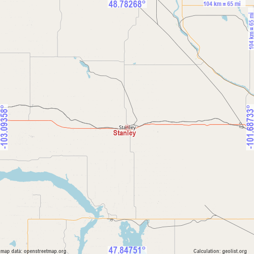
Stanley GPS coordinates[2]
48° 19' 2.064" North, 102° 23' 25.62" West
| Map corner | latitude | longitude |
|---|---|---|
| Upper-left | 48.78268°, | -103.09358° |
| Center: | 48.31724°, | -102.39045° |
| Lower-right: | 47.84751°, | -101.68733° |
| Map W x H: | 104×104 km | = 64.6×64.6mi |
| max Lat: | 71.29058° ⇑1% North |
| Stanley: | 48.31724° |
| min Lat: | ⇓99% South 19.06759° |
| min Long | Stanley | max Long |
| -171.73463° | -102.39045° | -66.98998° |
| W 18%⇐ | ⇒82% E |
Elevation
Elevation of Stanley is 685 m = 2247 ft, and this is 390.2 m = 1280 ft above average elevation for this country.
| Max E: |
3189 m = 10463 ft | 9.2% |
| Stanley | 685 m 2247 ft | |
| Avg. | 294.8 m = 967 ft | |
Min E: |
-60 m = -197 ft | 90.8% |
See also: United States elevation on elevation.city.
Geographical zone
Stanley is located in North temperate zone (between Tropic of Cancer and the Arctic Circle). Distance of this North polar circle is 2028.8 km =1260.6 mi to North.| Distance of | km | miles | from Stanley |
|---|---|---|---|
| North Pole | 4634.7 | 2879.9 | to North |
| Arctic Circle | 2028.8 | 1260.6 | to North |
| Tropic Cancer | 2766.5 | 1719 | to South |
| Equator | 5372.4 | 3338.3 | to South |


Nearby cities:
15 places around Stanley: (largest is in red/bold)
• Berthold
48.3 km =30 mi,  90°
90°
• Bowbells
55.1 km =34.2 mi,  11°
11°
• Burlington
71.3 km =44.3 mi, 93°
• Four Bears Village
39.7 km =24.7 mi,  200°
200°
• Kenmare
45.8 km =28.5 mi,  29°
29°
• Mandaree
68.7 km =42.7 mi, 197°
• Minot
81.5 km =50.6 mi,  96°
96°
• Minot Air Force Base
78.5 km =48.8 mi,  81°
81°
• Mohall
81.4 km =50.6 mi,  52°
52°
• New Town
38.1 km =23.7 mi,  191°
191°
• Parshall
44.7 km =27.8 mi,  154°
154°
• Ray
57.3 km =35.6 mi,  273°
273°
• Tioga
41.4 km =25.7 mi,  282°
282°
• Watford City
87.6 km =54.4 mi,  229°
229°
• Williston
92.9 km =57.7 mi,  258°
258°
Sources, notices
• [Note1] Compared only with cities in United States existing in our database
• [Src1] Map data: © OpenStreetMap contributors (CC-BY-SA)
• [Src2] Other city data from geonames.org with taken over terms of usage.
• [Src3] Geographical zone / Annual Mean Temperature by Robert A. Rohde @ Wikipedia
