Ray geodata
Ray (North Dakota) is a populated place; located in United States in America/Chicago (GMT-5) time zone. With population of 729 people, there are 18409 cities with bigger population in this country. Compared to other cities in United States, 99% of cities are located further ↓South; 82.3% of cities are located further →East and 90.9% of cities have lower elevation than Ray. Note1


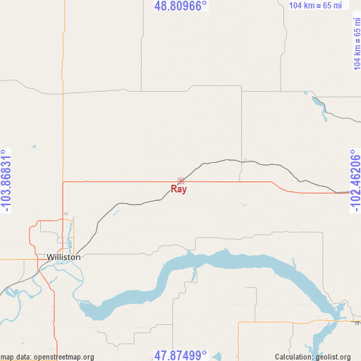
Ray GPS coordinates[2]
48° 20' 40.092" North, 103° 9' 54.648" West
| Map corner | latitude | longitude |
|---|---|---|
| Upper-left | 48.80966°, | -103.86831° |
| Center: | 48.34447°, | -103.16518° |
| Lower-right: | 47.87499°, | -102.46206° |
| Map W x H: | 103.9×103.9 km | = 64.6×64.6mi |
| max Lat: | 71.29058° ⇑1% North |
| Ray: | 48.34447° |
| min Lat: | ⇓99% South 19.06759° |
| min Long | Ray | max Long |
| -171.73463° | -103.16518° | -66.98998° |
| W 17.7%⇐ | ⇒82.3% E |
Elevation
Elevation of Ray is 692 m = 2270 ft, and this is 397.2 m = 1303 ft above average elevation for this country.
| Max E: |
3189 m = 10463 ft | 9.1% |
| Ray | 692 m 2270 ft | |
| Avg. | 294.8 m = 967 ft | |
Min E: |
-60 m = -197 ft | 90.9% |
See also: United States elevation on elevation.city.
Geographical zone
Ray is located in North temperate zone (between Tropic of Cancer and the Arctic Circle). Distance of this North polar circle is 2025.8 km =1258.8 mi to North.| Distance of | km | miles | from Ray |
|---|---|---|---|
| North Pole | 4631.7 | 2878 | to North |
| Arctic Circle | 2025.8 | 1258.8 | to North |
| Tropic Cancer | 2769.5 | 1720.9 | to South |
| Equator | 5375.4 | 3340.1 | to South |


Nearby cities:
15 places around Ray: (largest is in red/bold)
• Berthold
105.6 km =65.6 mi,  91°
91°
• Bowbells
84.7 km =52.6 mi,  52°
52°
• Crosby
64.1 km =39.8 mi,  351°
351°
• Culbertson
102.5 km =63.7 mi,  257°
257°
• Fairview
84.9 km =52.8 mi,  230°
230°
• Four Bears Village
59.2 km =36.8 mi,  132°
132°
• Kenmare
87.8 km =54.6 mi,  65°
65°
• Mandaree
77.5 km =48.2 mi,  152°
152°
• New Town
64.3 km =40 mi, 128°
• Parshall
87.9 km =54.6 mi,  119°
119°
• Sidney
101.5 km =63.1 mi, 226°
• Stanley
57.3 km =35.6 mi, 93°
• Tioga
17.8 km =11.1 mi, 70°
• Watford City
60.9 km =37.8 mi,  188°
188°
• Williston
40.1 km =24.9 mi,  236°
236°
Sources, notices
• [Note1] Compared only with cities in United States existing in our database
• [Src1] Map data: © OpenStreetMap contributors (CC-BY-SA)
• [Src2] Other city data from geonames.org with taken over terms of usage.
• [Src3] Geographical zone / Annual Mean Temperature by Robert A. Rohde @ Wikipedia
