Crosby geodata
Crosby (North Dakota) is a seat of a second-order administrative division; located in United States in America/Chicago (GMT-5) time zone. With population of 1,408 people, there are 14072 cities with bigger population in this country. Compared to other cities in United States, 99.4% of cities are located further ↓South; 82.4% of cities are located further →East and 89.6% of cities have lower elevation than Crosby. Note1


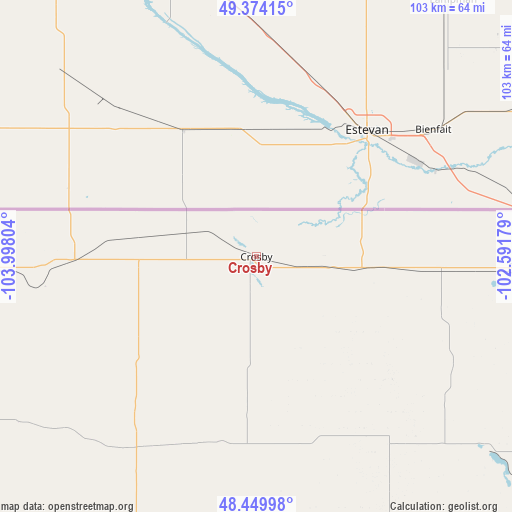
Crosby GPS coordinates[2]
48° 54' 51.12" North, 103° 17' 41.676" West
| Map corner | latitude | longitude |
|---|---|---|
| Upper-left | 49.37415°, | -103.99804° |
| Center: | 48.9142°, | -103.29491° |
| Lower-right: | 48.44998°, | -102.59179° |
| Map W x H: | 102.8×102.8 km | = 63.9×63.9mi |
| max Lat: | 71.29058° ⇑0.6% North |
| Crosby: | 48.9142° |
| min Lat: | ⇓99.4% South 19.06759° |
| min Long | Crosby | max Long |
| -171.73463° | -103.29491° | -66.98998° |
| W 17.6%⇐ | ⇒82.4% E |
Elevation
Elevation of Crosby is 598 m = 1962 ft, and this is 303.2 m = 995 ft above average elevation for this country.
| Max E: |
3189 m = 10463 ft | 10.4% |
| Crosby | 598 m 1962 ft | |
| Avg. | 294.8 m = 967 ft | |
Min E: |
-60 m = -197 ft | 89.6% |
See also: United States elevation on elevation.city.
Geographical zone
Crosby is located in North temperate zone (between Tropic of Cancer and the Arctic Circle). Distance of this North polar circle is 1962.4 km =1219.4 mi to North.| Distance of | km | miles | from Crosby |
|---|---|---|---|
| North Pole | 4568.3 | 2838.6 | to North |
| Arctic Circle | 1962.4 | 1219.4 | to North |
| Tropic Cancer | 2832.8 | 1760.2 | to South |
| Equator | 5438.7 | 3379.5 | to South |


Nearby cities:
15 places around Crosby: (largest is in red/bold)
• Berthold
132.6 km =82.4 mi,  120°
120°
• Bowbells
77.7 km =48.3 mi,  99°
99°
• Culbertson
124.2 km =77.2 mi,  226°
226°
• Fairview
130 km =80.8 mi,  205°
205°
• Four Bears Village
116.3 km =72.3 mi,  152°
152°
• Kenmare
92.7 km =57.6 mi,  106°
106°
• Mohall
131.5 km =81.7 mi, 97°
• New Town
119.5 km =74.3 mi, 150°
• Parshall
136.9 km =85.1 mi,  141°
141°
• Plentywood
94 km =58.4 mi,  260°
260°
• Ray
64.1 km =39.8 mi,  171°
171°
• Stanley
93.9 km =58.3 mi,  134°
134°
• Tioga
63.2 km =39.3 mi,  155°
155°
• Watford City
123.6 km =76.8 mi,  179°
179°
• Williston
88.6 km =55.1 mi,  195°
195°
Sources, notices
• [Note1] Compared only with cities in United States existing in our database
• [Src1] Map data: © OpenStreetMap contributors (CC-BY-SA)
• [Src2] Other city data from geonames.org with taken over terms of usage.
• [Src3] Geographical zone / Annual Mean Temperature by Robert A. Rohde @ Wikipedia
