Williston geodata
Williston (North Dakota) is a seat of a second-order administrative division; located in United States in America/Chicago (GMT-5) time zone. With population of 26,977 people, there are 1857 cities with bigger population in this country. Compared to other cities in United States, 98.8% of cities are located further ↓South; 82.5% of cities are located further →East and 89.2% of cities have lower elevation than Williston. Note1
Administrative division(s):
- Level 1: North Dakota
- Level 2: Williams County
- Level 3: City of Williston


Williston GPS coordinates[2]
48° 8' 49.092" North, 103° 37' 4.692" West
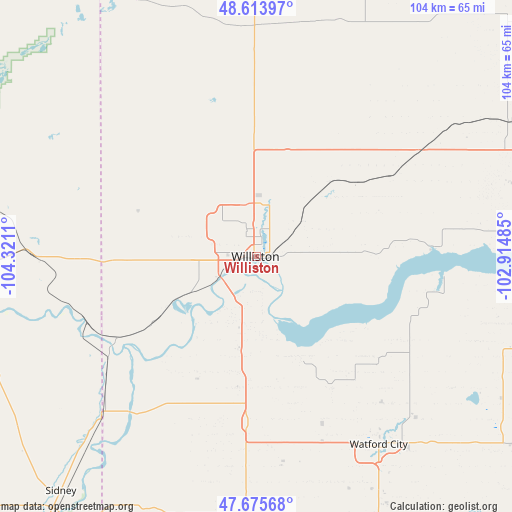
| Map corner | latitude | longitude |
|---|---|---|
| Upper-left | 48.61397°, | -104.3211° |
| Center: | 48.14697°, | -103.61797° |
| Lower-right: | 47.67568°, | -102.91485° |
| Map W x H: | 104.3×104.3 km | = 64.8×64.8mi |
| max Lat: | 71.29058° ⇑1.2% North |
| Williston: | 48.14697° |
| min Lat: | ⇓98.8% South 19.06759° |
| min Long | Williston | max Long |
| -171.73463° | -103.61797° | -66.98998° |
| W 17.5%⇐ | ⇒82.5% E |
Elevation
Elevation of Williston is 573 m = 1880 ft, and this is 278.2 m = 913 ft above average elevation for this country.
| Max E: |
3189 m = 10463 ft | 10.8% |
| Williston | 573 m 1880 ft | |
| Avg. | 294.8 m = 967 ft | |
Min E: |
-60 m = -197 ft | 89.2% |
See also: United States elevation on elevation.city.
Geographical zone
Williston is located in North temperate zone (between Tropic of Cancer and the Arctic Circle). Distance of this North polar circle is 2047.7 km =1272.4 mi to North.| Distance of | km | miles | from Williston |
|---|---|---|---|
| North Pole | 4653.6 | 2891.6 | to North |
| Arctic Circle | 2047.7 | 1272.4 | to North |
| Tropic Cancer | 2747.5 | 1707.2 | to South |
| Equator | 5353.4 | 3326.4 | to South |


Nearby cities:
15 places around Williston: (largest is in red/bold)
• Crosby
88.6 km =55.1 mi,  15°
15°
• Culbertson
66.7 km =41.4 mi,  269°
269°
• Fairview
45.3 km =28.1 mi,  224°
224°
• Four Bears Village
79.4 km =49.3 mi,  103°
103°
• Killdeer
107.7 km =66.9 mi,  143°
143°
• Mandaree
84.1 km =52.3 mi,  123°
123°
• New Town
85.8 km =53.3 mi, 102°
• Parshall
112.3 km =69.8 mi, 101°
• Plentywood
98.6 km =61.3 mi,  315°
315°
• Poplar
117.3 km =72.9 mi, 268°
• Ray
40.1 km =24.9 mi,  56°
56°
• Sidney
62.4 km =38.8 mi, 219°
• Stanley
92.9 km =57.7 mi,  78°
78°
• Tioga
57.5 km =35.7 mi, 61°
• Watford City
45.7 km =28.4 mi,  146°
146°
Sources, notices
• [Note1] Compared only with cities in United States existing in our database
• [Src1] Map data: © OpenStreetMap contributors (CC-BY-SA)
• [Src2] Other city data from geonames.org with taken over terms of usage.
• [Src3] Geographical zone / Annual Mean Temperature by Robert A. Rohde @ Wikipedia
